Garmin Edge 800 GPS unit review
|$649.95
BikeRadar verdict
"If you’ve been shy of getting into GPS, this new 800 will convert you. Touchscreen and OS maps make it our top choice"
Shopping partners
With a touchscreen display and improved interface, the Edge 800 is an excellent successor to Garmin’s popular Edge 705 GPS bike computer. It’s easier to use and offers significant new features over the 705 including compatibility with a wider range of maps (including Ordnance Survey in the UK), temperature, and improved calorie counting.
The new full-colour, backlit display is 160x240 pixels, which is just big enough to make the detail of a 1:50,000 map useful. The resistive 37x55mm touchscreen – it needs pressure to activate it – uses an Apple iPhone-style swipe to switch displays, and provides a big target when you need to press a virtual button. It works fine in full-finger gloves or with numb hands, making it ideal for winter riding, and makes it easy to spell place names.
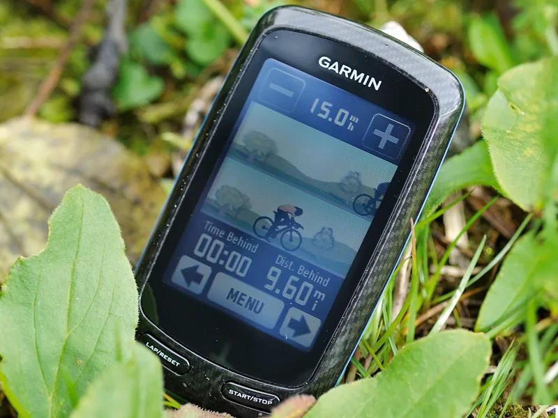
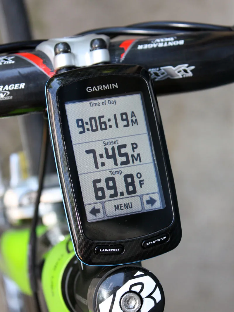
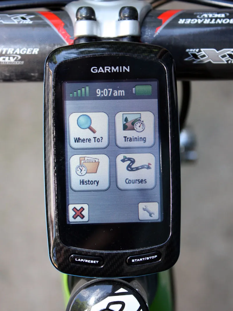
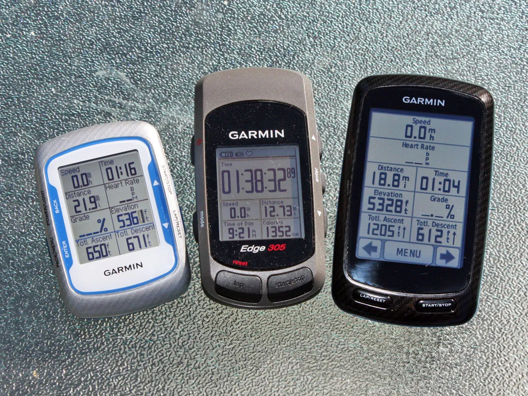
Ride data is presented in three customisable screens with up to 10 pieces of information on each, with each digit measuring at least 5mm tall. We configured our test unit to show all of our important ride data on one page, important time info (such as time of day and sunset) on another, and key post-ride data on a third.
Available data now available includes temperature, which is useful for training analysis and for showing off how hardcore you are. A notable improvement over the 705 is heart-rate-based calorie computation: the 800 gives a reasonably accurate figure for the total work on your ride, unlike the 705’s rather vague estimate.

Main ride data can set in a vast array of configurations, with up to 10 pieces of information spread over five lines
Mapping
The 800 is compatible with Garmin’s GB Discoverer range of OS maps.
A bundle is available with the complete
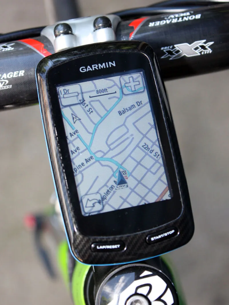
Garmin's City Navigator or TOPO maps can also be used, with a choice of turn-by-turn directions or a 1:24,000-scale topographical view of the surrounding terrain. Both can either be displayed in a new bird's-eye perspective or the usual 2-D environment. Subscribers to Garmin's BirdsEye Satellite Imagery service can even upload high-resolution satellite images to the Edge 800 and combine them with the other navigation data for an even more realistic view.
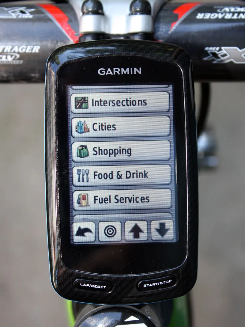
On-road navigating shows off Garmin's wealth of experience in the area, with intuitive destination selection and an impressive array of points of interest such as convenience stores and petrol stations – critical info if you're close to bonking. The easy-to-follow turn-by-turn directions have also been handy when we've been running errands or even when driving, though in the latter situation the screen is a touch on the small side.
As with previous Garmin GPS units, you can create routes on your computer using the included software and download other people’s rides or save your own at Garmin Connect. After each ride plug the 800 into your home computer and analyse your ride stats to see how far and how fast you rode. Data can then be accessed in graphs and charts.

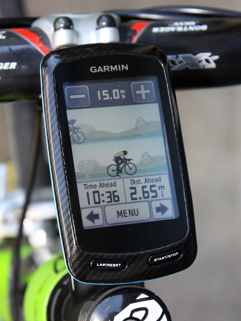
The Edge 800 offers either turn-by-turn directions on the road or a topographical perspective depending on what microSD card you've loaded - and you can also choose to look at the world around you in a bird's-eye view
Setup
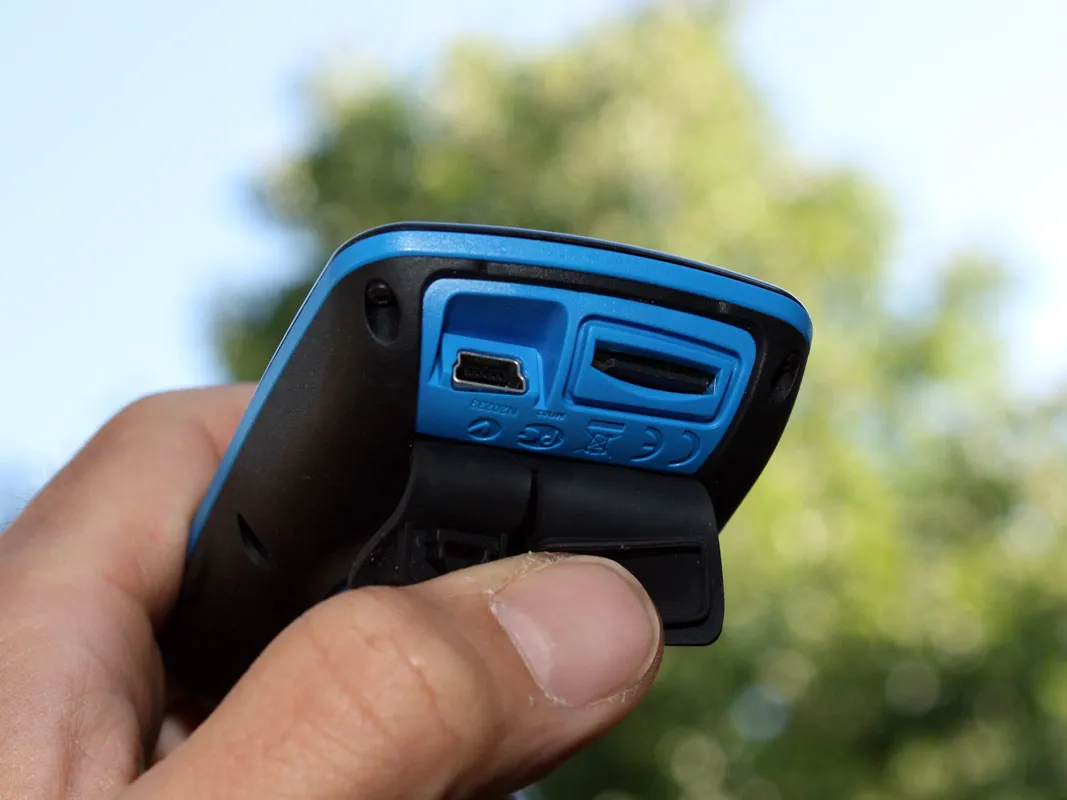
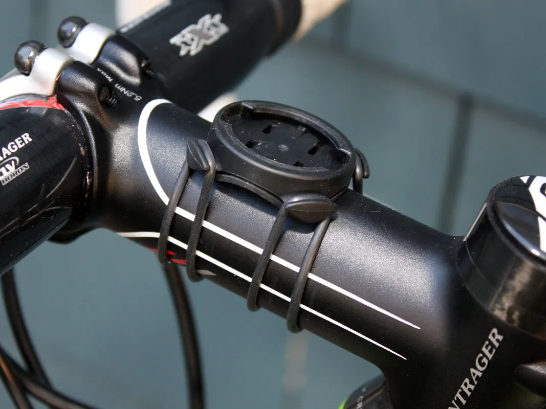
The 705's fragile bike mount is gone, replaced with the far better 90° twist ’n’ click mount introduced with the Edge 500. Fitting is easy: secure, twin rubber O-rings attach to your bar or stem in seconds. It’s simple to set up, too. Charge the Edge via its USB or mains charger, fit a mapping chip in the hidden microSD card slot under the unit, then switch it on and spend a minute telling the device about yourself.
There's no calibration necessary, but with a massive array of options on tap it's best to reserve a fair bit of time to get through it all. The unit's new firmware swaps more easily between different bikes for more accurate calorie counts and self-switching system configurations. The new touchscreen interface and updated firmware makes for notably more intuitive navigating of the various menus than before, and the appropriately sized 'buttons' are easy to hit even while rolling along at speed or with sweaty and/or dirty fingers.
If you start riding without hitting the start button, the 800 asks you if you want to start the timer, an improvement over the 705. Battery life is excellent; with a claimed 18 hours we did seven days of riding with power to spare. Power Chimp make an auxiliary battery that’s worth checking out though.
Bundles

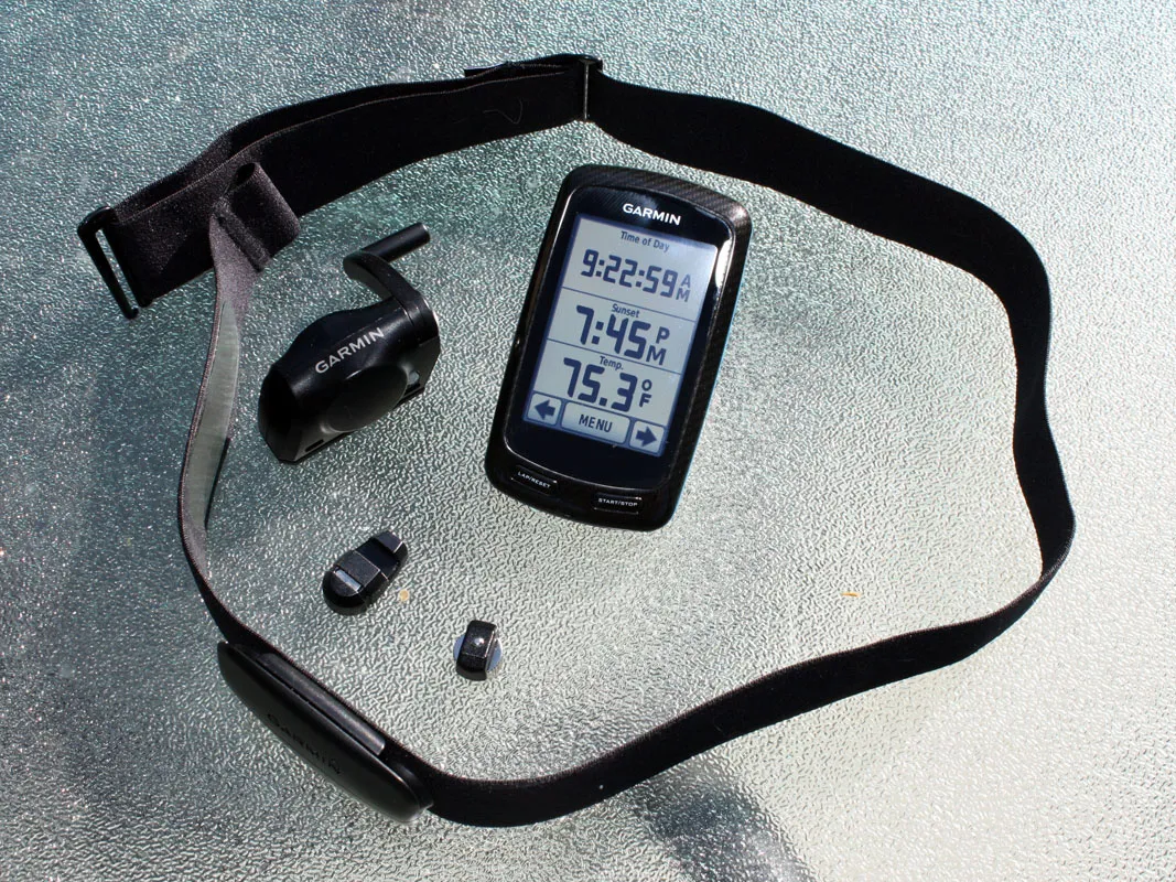
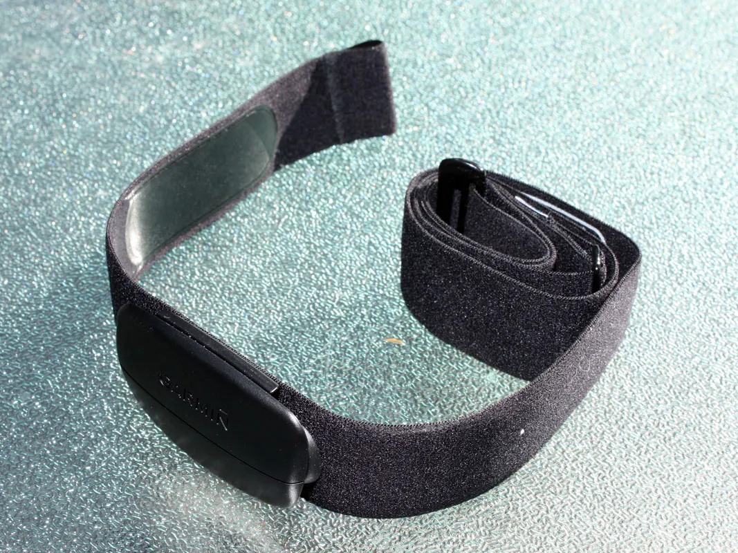
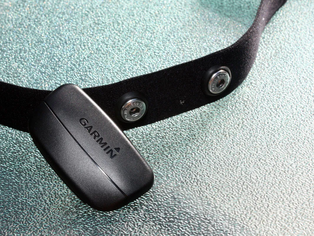
Garmin will offer the Edge 800 as a standalone unit or in various bundled packages. This option includes a City Navigator microSD card, a wireless speed and cadence sensor, and the company's new premium heart-rate monitor strap
The Edge 800 is available in a range of bundles with various options of maps, heart rate monitor and speed/cadence units. UK prices begin at £349 for the standard 800, £399 gets you the cadence/heart rate kit too, and £449 the top-end model including mapping, as tested here. In the US the Edge 800 is available in two configurations: a standalone version for US$449.99 or a preconfigured bundle for $649.99 that adds a wireless speed and cadence sensor, a City Navigator microSD card and a heart rate monitor strap.
There were reports of erratic readings with early versions of Garmin’s comfy, washable fabric Premium Heart Rate Monitor, but ours performed faultlessly. It's not only heaps more comfortable to wear than the previous iteration but it records electrical signals as soon as you put it on (no more wetting of electrodes!) and thanks to the detachable transmitter it's officially approved for hand washing. An ANT+ wireless receiver enables integration with various third-party power meters or the optional speed and cadence sensor.
Overall, the Edge 800 is the best bike-specific GPS unit we’ve used. It had us hooked on using it every ride. It’s robust, with logical menus, and its touchscreen is both easy and fun to use. The screen didn’t scratch despite lots of prodding with muddy fingers, and it’s waterproof. It supplies all the data we knew we wanted, and some we didn't, but you never feel bogged down in info. The battery life has been addressed and we can pack in the hours without it taking a nap before the end of the ride; a frustration we had before.
What's the score with BikeRadar reviews? You can find a full explanation of our ratings here.
User Reviews
There are 43 reviews on this post
Showing 1 - 30 of 43 comments
-
antfly
Posted Thu 17 Feb, 10:40 am GMT Flag as inappropriate
The price needs to come down about 200 quid or it's just a rich man's toy.
-
agg25
Posted Thu 17 Feb, 11:14 am GMT Flag as inappropriate
You can buy online for £278
-
hatone
Posted Thu 17 Feb, 11:16 am GMT Flag as inappropriate
I'm left wondering after reading this review whether I should opt for the Edge 800 over 500? Though I read, in forums, the Edge 800 is still plagued with minor problems which haven't been entirely addressed.
-
alchemiSSt
Posted Thu 17 Feb, 11:18 am GMT Flag as inappropriate
From my experience the unit is not even water resistant - let alone water proof.
My less than a month old unit filled with water under both the touch screen and the next layer of the screen on a drizzly summer day ride here in Sydney and began malfunctioning. So far Garmin have not been unresponsive on warranty.
So make sure you avoid bright lights, don't get it wet, and never feed it after midnight.
-
nick-williams
Posted Thu 17 Feb, 11:30 am GMT Flag as inappropriate
does anyone if the mount lifts the actual unit up high enough to clear shorter stems? I'm thinking of getting one, but only if I can stem mount it on my MTB. I'm using a 90mm stem right now
-
nbrus
Posted Thu 17 Feb, 1:21 pm GMT Flag as inappropriate
What we really want is a single GPS I can use for everything ... car, bike, hiking, etc ... with full OS maps built-in ... not expensive OS area maps that need to be purchased separately and cannot all be loaded at one time ... then I would buy one, even at this price.
-
flet©h
Posted Thu 17 Feb, 1:29 pm GMT Flag as inappropriate
nbrus - apple make one of those, it's called an iPhone
-
Mr. Bifidus
Posted Thu 17 Feb, 2:22 pm GMT Flag as inappropriate
nbrus - see [url=http://www.bikeradar.com/forums/viewtopic.php?t=12756877]here[/url]
-
nbrus
Posted Thu 17 Feb, 3:08 pm GMT Flag as inappropriate
An iPhone isn't the answer ... it requires a contract plus you need to be within range of a transmitter.
-
Bengdogg
Posted Thu 17 Feb, 3:19 pm GMT Flag as inappropriate
Re the one gps for all. Not a perfect solution but I use a Garmin 500 for training and data recording and view ranger on my phone for OS maps and guidance using the gps (this is more when hiking but sometimes I come unstuck on the bike too and need to have a look at a map when you end up in places you haven't even heard of). iphone with its built in battery has limitations so I run Viewranger on an old nokia which I have 3 batterys for to give several days use. Failing that always carry a map and compass too
-
kettrinboy
Posted Thu 17 Feb, 3:27 pm GMT Flag as inappropriate
i,m pleased overall with the 800, but there are still some ongoing problems,ie with the firmware not ignoring the odd bad waypoint which can send you according to the map halfway across the road, also despite being able to set the starting elevation to a known value, on the last two rides the finishing elevation has been 8-10m below the starting elevation thats on a door to door route,and theres issues when using courses and routes,but hopefully these bugs will be sorted in firmware upgrades, when they are i could give the 800 full marks, but at the moment no more than 4 out of 5
-
Tri harder
Posted Thu 17 Feb, 4:27 pm GMT Flag as inappropriate
Purchased mine last week and used it for the first time whilst out on the club run, my cadence magnet fell off at some point during the ride (despite having been zip tied and stuck to the crank) and on the return leg of our ride it kept shutting itself off! I don't know if this was due to the cadence magnet causing it to become confused after it fell off.
Have ordered another magnet, hopefully better luck next time.
I do have to say, on a positive note, that the amount of information you can get from the edge 800 is impressive, but 10 fields on one screen is too much, I would say 6 is the max if you want to read it on the fly without crashing!
nick-williams - I have mounted the Edge 800 on to my road bike stem and it is only 90mm.
-
planeetx
Posted Thu 17 Feb, 5:12 pm GMT Flag as inappropriate
I user this: http://www.sports-tracker.com/
Use it with my Nokia E51 and a separate GPS receiver (~£20). Cheap as Chips, no contract and it works just fine :^)
-
radirpok
Posted Thu 17 Feb, 6:48 pm GMT Flag as inappropriate
160x240 pixels? You must be joking. Even the Oregon has 240x400 and I thought that was low res. Welcome to the 90s?
I wonder when will the first GPS company realize that the era of the traditional units is over... Create the best cycling / navigator app for the Android and produce a waterproof, scratch-resistant body - and I'll ditch my ZTE Blade (resolution: 480x800, price: ~100 quid!) and buy that unit. Until then.... No thanks.
-
Sadoldsamurai
Posted Thu 17 Feb, 7:07 pm GMT Flag as inappropriate
Agree about the price needing to be below 200 (although the whole of british isles for 50 quid as part of the package has got to be a no brainer..), and
what about those of us who are committed to the Viewranger (symbian phones using O/S) option;
will our maps load onto this system, or
will we be able to get converter software?
-
dmjb3
Posted Thu 17 Feb, 7:58 pm GMT Flag as inappropriate
Way, way overpriced and effectively obselete. You can pick up a contract-free smartphone and bike mount for the same price (or less, a lot less in some cases) than the basic package here, which would deliver all the same features plus, well, it's a smartphone.
Maps, cadence and even bluetooth HRMs are all now commonly available for popular smartphone types (android, nokia, windows mobile etc.)
These types of GPS and phones are equally fragile, and as most of us take a phone for emergencies anyhow, I fail to see how a standalone bike GPS can be recommended apart from for real niche applications.
-
radirpok
Posted Thu 17 Feb, 9:55 pm GMT Flag as inappropriate
Actually, the Motorola Defy phone is IP67-rated, and costs about 250 pounds new. So now all we need is a killer app... good bye, Garmin.
-
lochindaal
Posted Thu 17 Feb, 10:31 pm GMT Flag as inappropriate
I've got one and it's a great device. Amazing how many people are knocking it that don't own one.
Good luck with your smartphone battery lasting a long Sportive with the GPS turned on
-
shricthism
Posted Thu 17 Feb, 10:51 pm GMT Flag as inappropriate
I think its a great device - my one concern is that the seal on the micro usb socket is hard to refit and I wonder about its water proofness.
Contrary to what is said above you can get all UK OS maps on one card.
-
shricthism
Posted Thu 17 Feb, 10:55 pm GMT Flag as inappropriate
I can only assume that those people who say they could use a smart phone to do what this device does only go cycling on sunny days in summer. The garmin is far more resilient than any smart phone. You can also operate it with winter gloves on - can you do that with a smartphone?
-
Sea-urchin
Posted Thu 17 Feb, 11:44 pm GMT Flag as inappropriate
i have had one for a couple of months now and its an amazing bit of kit..!
i also have an iphone but sometimes you need the right tool for the job.
i also have a proper camera and video camera (both things i 'could' use the phone for).
i have ridden in all weathers, on road and off, its got muddy, been dropped, etc and its still going strong...
i couldnt fit it on my 65mm stem but it fits the top tube just fine.
-
starbuck310
Posted Fri 18 Feb, 7:43 am GMT Flag as inappropriate
I have garmin 450 for all uses, car cycling mtb. You can add all the same cadence and power meters to it the same as the edge series. They are a lot more robust than the edge. Great bit of kit. Used to get me from airports to mtb holiday in Spain and France. Then used on the trail. Equally at home on my road bike where it works just like a normal sat nav. Brilliant bit of kit but only if you really use it.
-
thelawnet
Posted Fri 18 Feb, 11:01 am GMT Flag as inappropriate
All very well to say 'use a smartphone', but my experience is that the iphone battery lasts about an hour doing smartphone.
I'd be surprised if you'd get even a morning's riding out of any smartphone while running GPS.
-
thelawnet
Posted Fri 18 Feb, 11:01 am GMT Flag as inappropriate
sorry that should read 'the iphone battery lasts about an hour doing satnav.'
-
petecycles
Posted Fri 18 Feb, 11:18 am GMT Flag as inappropriate
After a month's use I've had problems with the unit randomly recognising or not the computer for downloads, being unable to upload files, calculating routes over and over again when riding and sending me off route for periods, then finally two weeks ago a ride in the pouring rain has killed it. I'm waiting for a return on warranty but I'm back with my polar and not missing it at all. As seemed to be the case with the 705, again the 800 is a beta-version of a product sold to the public to test for them.
-
miesny
Posted Fri 18 Feb, 12:49 pm GMT Flag as inappropriate
Just got replacement for usb rubber protector. The original part does not fits perfectly :-( Besides this problem device is sexy rugged, has very good accessories, great software, exactly meets my needs (training and navigation on foot and wheels) . Before I used iPhone apps but this is completely different experience now.
I understand we have to pay for rugged version, long battery life and Garmin know-how, it still hurts though..
-
mrbodly
Posted Fri 18 Feb, 1:13 pm GMT Flag as inappropriate
I use an iphone 4 in a waterproof handlebar mount with Motion X. Using maps and navigation with Bluetooth, Wifi, 3G etc. turned off I get approx 4-5 hours battery use. With an external battery pack this bumps it up to 20+ hours.
When just tracking, I stick the iphone in my pocket and the battery lasts for eons. GPS receiver is absolutely spot on, haven't lost the signal yet.
Maps can be pre-downloaded so need for a signal whilst on the road.
Iphone works for me!
-
jm99
Posted Fri 18 Feb, 1:27 pm GMT Flag as inappropriate
Bought one in January. It was very expensive and a tricky decision, new wheels and fork or this? What would improve my riding experience, and chance of enjoying the Etape Du Dales the most? I chose the GPS, i need better legs not bike, would i get my money back if i could? No.
Excellent piece of kit, great battery life, intuitive to use and set up, rugged enough for 40km off road in winter and it also worked fine at -8C in big gloves. It has almost single handedly motivated me into 500km of riding on and off road since it arrived.
Only issues so far:
* I have not found a way to get the OS mapping onto the PC so i can plan off road routes without the device plugged in, using the Garmin software.
* In heavy rain on sandy ground the screen protector i bought got very scrached as sand filled water splashed everywhere. Not a big issue, however the area around the buttons got silted up and temporarily stopped working. A bit of TLC and a clean and is working fine again. Next time i am somewhere where i encounter really wet sandy conditions, e.g. kielder or peaks it may go in my pocket for some of the ride.
* The USB/card protector does seem flimsy, however no issues so far.
* They could have got a better tune for when you finish a course! That really is back to the 90's :)
-
miesny
Posted Fri 18 Feb, 1:34 pm GMT Flag as inappropriate
mrbodly you are right about iphone It works for me too. However iphone as an excellent and delicate phone is much more expensive not having HR monitor and cadence at the same time.
-
slimboyjim
Posted Fri 18 Feb, 8:04 pm GMT Flag as inappropriate
I use a smartphone with a power chimp external battery, so battery life isn't an issue for me. Where I do think the Garmin has a significant edge is it's download of training data - it's very good looking and informative. Would I spend £400 for that luxury though? Not now, but maybe in a couple of years if prices drop significantly.
Viewranger it is for the time being then...
Specification
- Name:
- Edge 800 (11)
- Built by:
- Garmin
- Price:
- $649.95
- Features:
- * Unit dimensions, WxHxD: 2" x 3.7" x 1" (5.1 x 9.3 x 2.5 cm) * Display size, WxH: 1.4" x 2.2" (3.8 x 5.6 cm); 2.6" diag (6.6 cm) * Display resolution, WxH: 160 x 240 pixels * Touchscreen: yes * Weight: 3.5 oz (98.0 g) * Battery: rechargeable lithium-ion * Battery life: 15 hours, typical * Water resistant: yes (IPX7) * GPS-enabled: yes * High-sensitivity receiver: yes * Basemap: yes * Ability to add maps: yes * Accepts data cards: microSD™ card (some versions include a CityNavigator microSD card) * What's in the Box: * Edge 800 * AC adapter * Bike mount * USB cable * Quick start manual
Related links
Also on BikeRadar
Racing

MTB World Cup Eliminator #3: Wins for Lüthi and Rissveds
Full results and report from...
Fitness

BikeRadar Training 1000 mile challenge leaderboard
First rider hits target...
News

Rotor and SRM partner on mountain bike power meter crankset
3D+ MTB Double available next...
News

Derby velodrome plans uncertain after change in council leadership
New Labour administration...
News

New wind tunnel and fitting service offered in UK
Prestige Cycles working with...
Magazines

At home with the Athertons
Gee, Rachel and Dan Atherton...


