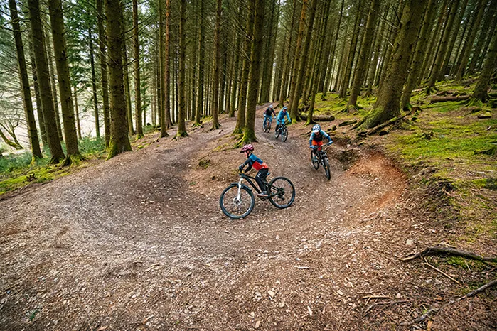
It's not difficult to see why we all love purpose-built trail centres so much: they're rideable whatever the weather, easily accessible throughout the UK and offer a good range of riding for different levels of ability.
We've gathered all the essential info on the best trail centres England has to offer in an up-to-date list, including how to find them, what the trails are like and what facilities they offer.
Most also have excellent facilities, including bike shops for those last-minute repairs and spares, and a trail hub with cafes, car parks and sometimes even showers.
Of course, there are plenty of excellent must-ride destinations in Wales, Northern Ireland and Scotland, so don't forget to check our guides to those locations, too.
Whether you’re a seasoned pro or are just starting out in the wonderful world of mountain biking, you can discover some of the best places to go and ride your bike.
Ashton Court trail guide

Ashton Court is a 15-minute ride from Bristol city centre and offers a great introduction for beginner mountain bikers.
The trails are on the grounds of the 850-acre estate and take in woodland and an open hillside that reveals views of Bristol below.
There is also a wide variety of off-piste trails built by locals, which offer more technical riding if you know where to look.
What facilities are there at Ashton Court?
There are plenty of facilities at Ashton Court to make hitting the trails easier.
Alongside a large car park, there is a cycle shop called Pedal Progression, which stocks spare components and offers bike hire for electric and non-assited mountain bikes.
On the grounds, there is a golf course, tree-tops activity and other facilities to keep family members entertained.
Toilets are also available on-site and food is available from The Courtyard Cafe.
How to get to Ashton Court
Ashton Court is based on the outskirts of Bristol and is a 15-minute ride from the centre.
Parking is accessed from the B3128 or the A369.
- Ashton Court postcode: BS41 9JN
What are the trails like at Ashton Court?
With shallow slopes and undulating terrain, the trails at Ashton Court are well suited to beginner and cross-country riding.
Deeper into Leigh Woods, there are more challenging off-piste trails for those wanting to get their steeze on.
Nova
The main trail is fairly flat, but still has plenty of pump and flow. There are enough berms and hidden gems along the route to keep you entertained, but there’s nothing too technical or demanding. It’s great for beginners and perfect fitness training for more experienced riders.
- Grade: Blue
- Distance: 6.5km
- Estimated time: 30 mins to 1 hour
Supernova
A short but sweet extension that’s packed with berms, jumps and rocky sections, ending with a more technical descent. It provides a good workout for the more experienced rider.
- Grade: Red
- Distance: 0.8km
- Estimated time: 1 to 5 mins
Cannock Chase trail guide

Cannock Chase holds up whatever the weather.
Cannock Chase is a firm favourite to many in the mountain biking community and is home to many waymarked mountain bike trails that are free to ride and open all year round.
Situated in the middle of England, Cannock is easy to get to and very popular, which sees it getting busy on the weekends.
What facilities are there at Cannock Chase?
Based in a multi-use forest, visitors to Cannock Chase can expect classic trail-centre facilities, including a dedicated cycle centre.
Bike hire and spare parts are available from the centre and pre- or post-ride fuel can be picked up from the Grounds Cafe.
A large car park offers plenty of space, even on the busiest of weekends.
There are also activities for the rest of the family, including frisbee golf and walking trails.
How to get to Cannock Chase
The cross-country trails begin at Birches Valley Visitor Centre. From Rugeley, take the A51 from the roundabout, where it joins the A460 and head north towards Wolseley Bridge. At the first traffic lights, turn left onto Hagley Road and follow it out of town. Turn left by the Birches Valley sign and left into the car park. For the downhill area, leave Rugeley on the A460 to Hednesford and turn left just outside town.
- Cannock Chase postcode: WS15 2UQ
What are the trails like at Cannock Chase?
With varying singletrack and well-built trails that offer year-round riding, Cannock Chase offers some of the best riding in the area.
Follow the Dog
Follow the Dog was the Midlands’ first dedicated MTB trail. It’s 75 per cent singletrack and aimed at beginner to intermediate riders. The trail is a mixed affair; fast and flowing, with some tight and technical sections. You should be able to ride the whole thing in less than an hour, but it’s entertaining enough to make a second lap worthwhile.
- Grade: Red
- Distance: 10.8km
- Estimated time: 45 mins to 1 hour 30 mins
The Monkey Trail
The start of The Monkey Trail is accessed via Follow the Dog. It’s more physically and technically demanding, with some trickier trail features and several black options. The trail is 80 per cent singletrack and finishes with the awesome Lower Cliff descent.
- Grade: Red
- Distance: 22.8km
- Estimated time: 2 to 3 hours (including The Monkey Trail)
Downhill area
Known as Stile Cop, this area boasts several DH runs. The tracks are only around a minute long, but they’re packed with jumps, drops and other technical features that require commitment, so aren’t suitable for inexperienced riders.
Dalby Forest trail guide

Dalby Forest is one of the bigger trail centres in England. It has everything from green family trails to black-graded XC loops and a bike park area.
The 34.3km red trail is a big undertaking, but it can be split into three distinct sections that can be ridden on their own, or with green and blue options to take you back to the start point if you don’t fancy the whole thing. It gives you the option to hit the awesome new blue-graded descent, which was completed last year.
What facilities are there at Dalby Forest?
Dalby Forest is well catered for, with two cafes situated on the site enabling you to get pre-, post- and mid-ride nutrition.
There is a large car park next to the visitor centre and plenty of activities for those less interested in two wheels. This includes archery, walking trails and a gallery.
How to get to Dalby Forest
Dalby Forest is on the edge of the North York Moors National Park. It’s situated just off the A169 from Pickering to Whitby. Turn right just before the Fox and Rabbit pub onto the Thornton-le-Dale road. The turn-off for the forest drive is on your left after a short way. Follow the brown tourist signs when approaching Dalby.
- Dalby Forest postcode: YO18 7LT
What are the trails like at Dalby Forest?
Dalby Forest has riding that suits all abilities, with flat rolling doubletrack and some of the best descents in the country.
The trails are well-built and provide good riding year-round thanks to good drainage.
Blue Trail
This route combines easy singletrack with open terrain and some steep sections. An awesome new descent of swooping berms and rollers opened last year.
- Grade: Blue
- Distance: 12.8km
- Estimated time: 1 to 2 hours
Red Trail
The Red Trail can be started from either Low Dalby or Dixon’s Hollow car park. It’s a long trail with lots of varied singletrack, and can be made into three separate routes by combining other blue and green trails. These also make good shortcuts if the full distance is a bit of a challenge for you.
- Grade: Red
- Distance: 34.3km
- Estimated time: 2 to 3 hours
World Cup XC
This strenuous pro-level track is best ridden while imagining you’re racing 30 other riders. It’s a bolt-on to the Red Trail and includes challenges such as the infamous Worry Gill and Medusa’s Drop.
- Grade: Black
- Distance: 6.4km
- Estimated time: 1 hour
Dixon's Hollow Bike Park
One for adrenaline junkies, with a 4X track and a jump line. A new 600m blue-graded pump trail/skills area opened in April this year.
Forest of Dean trail guide

Just over the border from Wales, Gloucestershire’s Forest of Dean is a popular place to ride. It’s full of great trails and there’s a buzzing atmosphere at the trailhead. There’s a mix of wide forest tracks, marked XC routes and plenty of DH trails to test your skills.
The downhill trails are easily accessed via the uplift service or a fire-road push-up, and the regular Mini DH and enduro events are a great way to cut your teeth racing. What’s more, the forest is full of great off-piste singletrack too, if you know where to look.
What facilities are there at the Forest of Dean?
The Forest of Dean has a trail centre, with food and beverages served for pre- and post-ride nutrition.
The centre also features the Pedalabikeaway shop, which offers cycle hire, repairs and essential items that you may have left at home.
Dean Forest Cycles is three miles away for any other needs.
There is a bike wash in the centre to clean your bike before heading home and showers to get the grime off yourself.
Uplifts are occasionally run by FlyUp Downhill, although these need to be booked in advance.
How to get to the Forest of Dean
The XC routes and DH trails are all accessed from the Cannop Cycle Centre, home to the Pedalabikeaway shop and cafe, just off the B4234.
- Forest of Dean postcode: GL16 7EH
What are the trails like at the Forest of Dean?
With trails that suit a wide range of abilities, the Forest of Dean has something for everyone.
The beginner trails offer a great introduction, while the harder trails can challenge even the best riders.
Plenty of off-piste trails are dotted around, giving backcountry vibes to this trail centre.
Family trail
This smooth and relatively flat route is perfect for families with little kids and the Forest of Dean in general is a very family-friendly location. At the weekends, there are regular children's club rides, with lots of child and youth races on offer.
- Grade: Green
- Distance: 17.5km
- Estimated time: 1 to 2 hours
Verderers trail
Packed with switchback climbs and beautiful berms, and with an exciting final descent, the Verderers may be ‘just a blue’, but it’s great fun whatever level you're at. Beginners can enjoy the flow and hone some skills, while experts can push their limits.
- Grade: Blue
- Distance: 11km
- Estimated time: 1 to 2 hours
Freeminer
This trail is really varied, with tight singletrack, and tricky climbs, drops and berms. The newest section of trail contains some more natural-feeling rooty singletrack, where line choice is critical. The Dean Trail Volunteers work super-hard to ensure all the trails are kept in good shape, so help them out with some elbow grease or a donation if you can.
- Grade: Red
- Distance: 11km
- Estimated time: 1 hour
Downhill tracks
There are seven marked runs in total, all of which take a couple of minutes to get down. They range from the berms and drops of GBU to the twisty goodness of Mr Rooty and Corkscrew. The slick uplift service operated by FlyUp Downhill offers a quick turnaround, or you can push up if you prefer.
Gisburn trail guide

Gisburn lies in the Forest of Bowland, a designated Area of Outstanding Natural Beauty, so you’re guaranteed some amazing scenery as you enjoy the trails.
There’s an easy blue route and a slightly harder and longer red XC route, neither of which will leave you feeling disappointed. Both start from the Gisburn Forest Hub car park, where you’ll also find a cafe and skills loop. Further into the forest, there are two downhill trails with berms, jumps and drop-offs.
What facilities are there at Gisburn?
Gisburn has an on-site cafe that serves food and drink throughout the day, as well as a small bike shop that sells essential components such as inner tubes.
There are also bike shops located in the vicinity for more specialist repairs.
A large car park accommodates plenty of vehicles and there is a toilet on the grounds.
How to get to Gisburn
Gisburn Forest Hub is near Slaidburn. Turn off the B6478 onto Dugdale Lane, then follow minor roads to the car park.
- Gisburn postcode: BB7 4TS
What are the trails like at Gisburn?
The trails at Gisburn are well built and hold up on even the wettest of winter days.
With plenty of variety for all levels of experience, Gisburn has something for everyone.
Bottoms Beck
This is a nice, short and easy ride that’s suitable for novices. The trail has a good combination of forest roads and singletrack, following an old railway line. That doesn’t mean it’s straight, though – you’ll twist and turn through Park Wood before finishing back in the car park with a big grin on your face.
- Grade: Blue
- Distance: 9.5km
- Estimated time: 1 to 2 hours
The 8
The 8 trail is a really fun loop that takes in a wide variety of terrain, from dark, twisting woodlands, to wide-open moorland. The landmark point of the ride is Whelpstone Crag and there are great technical rock features to ride around, as well as some stunning views. It’s worth trying the optional black line of Hully Gully too, which is a unique descent of big wall-ride berms.
- Grade: Red
- Distance: 18km
- Estimated time: 2 to 3 hours
Bike park
Hope Line and Leap of Faith are twisty DH trails that are under continuous development and maintenance by trail volunteers. Both trails are in the heart of the forest, about 3km from the Gisburn Forest Hub.
Grizedale trail guide

The Lake District is a mountain biking hotspot, with some of the best natural trails the UK has to offer.
Grizedale is slap-bang between two beautiful lakes, Coniston Water and Lake Windermere. It’s got some serious elevation, which gives panoramic views over Helvellyn and beyond.
The forest is famous for its outdoor sculptures, many of which can be viewed from the tamer trails. The red-graded North Face loop is perfect for intermediate riders who want an enjoyable but not overly technical singletrack ride. There’s also a short black trail full of jumps, berms and steep descents, with a double-black-diamond option that’s not for the faint-hearted.
What facilities are there at Grizedale?
Grizedale has a large visitor centre that houses the Biketreks bike shop, as well as a cafe.
The shop sells last-minute essentials and offers hire for electric and non-assisted bikes.
A power washer is available for cleaning your bike off before heading home and there are toilets on site.
How to get to Grizedale
Head north out of Hawkshead, turn right up a tiny lane signposted to Grizedale and the trail centre is two miles down the road.
- Grizedale postcode: LA22 0QJ
What are the trails like at Grizedale?
Grizedale makes a great introduction to mountain biking, with the lower-rated routes offering fast yet not technical trails to build up confidence on.
There is also something for those looking for more involving riding, with berms, jumps and drops featuring on black optional lines.
The North Face
The North Face trail is an entertaining route, which is rideable by less experienced bikers, yet also a lot of fun for better riders. It has some leg-burning climbs, which will test your uphill strength as much as the downhills test your skills. There are some high-speed sections, boardwalk, rocks and an optional 1km black stretch that can be ridden as part of the red route or on its own.
- Grade: Red
- Distance: 16km
- Estimated time: 2 to 3 hours
Hadleigh Park trail guide

Hadleigh Park in Essex carries the London 2012 legacy on its shoulders – ride here and you'll feel like an Olympic athlete! After the Games, the XC racetrack was adapted for the public and split into blue, red and black-graded sections, meaning there’s something for everyone.
What facilities are there at Hadleigh Park?
Hadleigh Park has the aptly named Hub Cafe on-site for your pre- and post-ride nutrition, next to which is Hadleigh Park Cycles.
The shop offers bike hire, as well as small repairs and essential components to get you riding again.
There is also a fishery on the grounds should you wish to swap your bike for your rod.
How to get to Hadleigh Park
Leave the M5 at junction 30 and follow the A13 towards Southend-on-Sea. In Hadleigh, turn down Castle Lane to the visitor centre.
- Hadleigh Park postcode: SS7 2PP
What are the trails like at Hadleigh Park
As you’d expect, the trails are well planned and built, and rideable in all weathers. It’s an easily accessible location with great facilities, but don’t come here expecting airtime or long descents. This is pure-bred XC territory, so bike up accordingly and you’ll have a great time.
2012 Olympic XC
Designed to test the best athletes in the world, the 5km Olympic cross-country course contains almost 1.7km of climbing per lap, as well as a number of sharp technical descents. Riding it fast is a real test of fitness, and taking on the optional black lines, such as Deanes Drop and The Leap of Faith, will challenge your skills and nerve too.
Being split into blue, red and black sections, it gives beginners and intermediate riders an idea of what they might expect to find. Several sections of the red trail have been rebuilt and spruced up, so it should be in prime condition. There’s also a skills area to warm up in, as well as a pump track.
Haldon Forest trail guide

It may be just a stone’s throw from the M5, but this woodland mountain bike sanctuary succeeds in making you feel as if you’ve been transported to deepest, darkest Devon.
Beautiful scenery and dense forest follow you around the trails, and there is something for every riding level.
What facilities are there at Haldon Forest?
Haldon Forest has an on-site cafe called The Ridge Cafe, which provides food and refreshments throughout the day.
There is also cycle hire provided by Forest Cycle Hire on the grounds, who should be able to help out with small workshop repairs.
Toilets are available on-site, and there are plenty of walking trails for those in your party who aren’t riding.
How to get to Haldon Forest
The centre is just off the A38, near Exeter racecourse. Follow the brown tourist info signs to the car park.
- Haldon Forest postcode: EX6 7XR
What are the trails like at Haldon Forest?
There are several waymarked trails, as well as some off-piste singletrack if you know where to look. The red-graded Ridge Ride begins with a flat and then downhill start, at odds with many UK trail centres. It’s great fun, but make sure you’re warmed up first – you can do this in the skills area by the car park.
Discovery
A well-surfaced route for beginners and families. Walkers use this trail too, so be aware.
- Grade: Green
- Distance: 2.4km
- Estimated time: 30 minutes
Ridge Ride
This would be more aptly described as a pink trail rather than a red. The not-too-difficult singletrack that weaves through the trees is fun and flowy and the downhill start away from the car park is a welcome change. There’s a black-graded 1km option, the Ridge Ride Extreme, which is a technical loop with more difficult trail obstacles.
- Grade: Red
- Distance: 9.6km
- Estimated time: 1 to 2 hours
Skills/pump track
The skills area is designed to give a taster of the features you’ll find out on the marked trails. The pump track is a decent length and lots of fun.
Hamsterley trail guide

On the edge of the wild North Pennines, the trails at Hamsterley Forest are cut into a steep-sided valley hidden in 2,000 hectares of woodland. There are three XC routes, totalling more than 30km of flowing singletrack and a playground of downhill trails. Combining the two trail flavours makes for an exciting and varied place to ride.
Danny Hart’s Descend Bike Park is also down the road, offering riders bike features and an uplift service.
What facilities are there at Hamsterley?
Hamsterley has a cafe, as well as a bike shop that offers essential equipment you’ve likely left at home before.
The shop also offers bike hire for electric and non-assisted bikes.
The large car park is pay and display, and there are toilets available on-site.
How to get to Hamsterley
From Durham, head south on the A690 towards Crook. Stay on this road as it becomes the A689 at Crook and turn left at the roundabout junction with the A68. Head for Darlington and turn right after three miles, following signs for Hamsterley.
Once in Hamsterley, turn right into the centre, cross the river and go left up the forest drive. The bike park has its own car park, go through Hamsterley village and look out for it on the right after three miles.
- Hamsterley postcode: DL13 3NL
What are the trails like at Hamsterley?
The sweeping trails at Hamsterly are some of the best, taking in a wide variety of terrain.
This variety also makes it a great choice for beginners looking to improve their skills.
Blue trail
A wide route that uses purpose-built cycle trails, forest roads and the tarmac forest drive to explore the forest.
- Grade: Blue
- Distance: 14.5km
- Estimated time: 1 to 2 hours
Red trail
This is a longer, harder version of the Blue trail, taking you to the further reaches of the forest on a mixture of fire roads and singletrack. There are superb views at the top, overlooking Eggleston Moor. The trail follows a figure-of-eight route, crossing over itself at The Grove car park. It passes the aforementioned Descend Bike Park if you fancy a few laps.
- Grade: Red
- Distance: 23.5km
- Estimated time: 2 to 3 hours
Black trail
The Black trail is both strenuous and technically challenging. It combines steep, technical climbs, smooth singletrack and great rooty descents into a natural-feeling route.
- Grade: Black
- Distance: 13km
- Estimated time: 1 to 2 hours
Descend Bike Park
The five DH tracks are tough and technical, with steep rock chutes, berms to rail and jumps of all sizes. There’s a great 4X course too.
Kielder trail guide

Sitting in the middle of a massive forest, the man-made trails at Kielder are a solid addition to the region. The paths have plenty of singletrack, a few tough climbs and some technical riding.
What facilities are there at Kielder?
Kielder has a large cafe on site that serves food throughout the day and there is a bike shop on the grounds that hires bikes and stocks often-forgotten essentials.
A large car park has capacity for plenty of vehicles and there are even glamping pods on-site should you wish to make a weekend of your visit.
There's an array of water sports for those less bike-orientated, with northern Europe's largest man-made reservoir nearby.
How to get to Kielder
From Newcastle or Carlisle, follow the A69 to Hexham, then the B6320 to Bellingham (signed Kielder Water and Forest), then the C200 to Kielder Water and Forest Park. From Jedburgh or south-east Scotland, take the A68 south then the B6320 from Otterburn to Bellingham. Follow the brown signs to Kielder Water and Forest Park. From south-west Scotland, follow the A7. Leave the road at Canonbie to join the B6357 to Newcastleton, and Kielder Water and Forest Park is signposted from there.
- Kielder postcode: NE48 1HX
What are the trails like at Kiedler?
A wide range of riding is on offer at Kiedler, from flowing singletrack to tough, technical enduro tracks.
The trails are well-maintained and remain consistent throughout the year.
Osprey
Osprey is an open, flowing trail designed for riders who love a good cross-country blast
- Grade: Blue
- Distance: 20.5km
- Estimated time: 2 to 3 hours
Lonesome Pine
If you like views, you’re in for a treat – on Lonesome Pine, you can see for miles. The trail also has one of the UK’s longest sections of North Shore woodwork.
- Grade: Red
- Distance: 19.7km
- Estimated time: 2 to 4 hours
Up and Over
The black trail branches off the Deadwater red route, adding a tricky climb and technical downhill.
- Grade: Black
- Distance: 10.2km
- Estimated time: 1 to 2 hours
Sherwood Pines trail guide

Sherwood Pines Forest Park mustn’t be confused with Sherwood Forest – there’s much more riding at the former. Fast woodland singletrack is the order of the day, with a couple of purpose-built XC loops, over 45km of unmarked trails (keep your eyes peeled), a skills area and a bike park complete with a set of dirt jumps. The centre sits right on National Cycle Network Route 6, so it’s easy to get to by bike.
What facilities are there at Sherwood Pines?
Sherwood Pines has a cafe on-site, as well as a bike shop that offers bike hire and repair, and sells essential components.
There is also a Go Ape high rope course in the grounds for those looking for adrenaline off the bike.
A golf course and walking trails are also situated near the trailhead.
How to get to Sherwood Pines
From Mansfield, take the A6030, following signs for Clipstone and Ollerton. Go past these places and under the railway bridge, and Sherwood Pines is well signposted.
- Sherwood Pines postcode: NG21 9JL
What are the trails like at Sherwood Pines?
The trails at Sherwood Pines offer good variety, with something for everyone available, whether you’re just starting out or have been riding for years.
Family
As the name says, this is an easy family trail. It can also be accessed from the nearby Center Parcs holiday park.
- Grade: Green
- Distance: 4.8km
- Estimated time: 1 hour
Adventure
Twice the length of the family trail, but not any more technical, this route uses the green trail and the nearby NCN route to take riders deeper into the forest.
- Grade: Blue
- Distance: 9.6km
- Estimated time: 1 to 2 hours
Kitchener
Named after the famous British military leader, this flowing, twisty singletrack trail is great fun and a challenge to ride at speed. It’s a great introduction for riders wanting to progress onto trickier trails. Look out for some ‘hidden’ off-piste singletrack too.
- Grade: Red
- Distance: 12.8km
- Estimated time: 1 to 2 hours
Bike park
The bike park has two very different sections – the dirt jump area and the downhill zone. The dirt jumps are a series of graded jumps with a warm-up section. The DH zone contains technical features and challenging terrain, with a number of interlinking descents that criss-cross their way down the hillside.
Swinley Forest trail guide

Just a stone’s throw from London, this trail centre has developed over the years to be a well-recogised destination.
What facilities are there at Swinley Forest?
Swinley Forest has all the essentials that make for a brilliant trail centre, with a large cafe serving food and drink through the day, and a bike shop on-site offering hire and maintenance, and supplying those easily forgotten components.
There are toilets available to the public, and there is a power washer available for cleaning your bike.
How to get to Swinley Forest
All the new trails start at The Look Out Discovery Centre. It’s off the A322, which runs between the M3 (Junction 3) and the M4 (Junction 4). Follow the brown tourist signs to The Look Out and Coral Reef. Turn off the A322 onto Nine Mile Ride (B3430) at a roundabout about four miles up from the M3. The Look Out is on your left after about 100m.
- Swinley Forest postcode: RG12 7QW
What are the trails like at Swinley Forest?
Swinley Forest has something for everyone, with trails ranging from green to black, and disciplines open for XC to downhill.
The trails are well-built and perform well all year.
Green trail
The Green is a typical wide family trail, but with two 25m loops that are twisty, fun and suitable for very small wheels.
- Grade: Green
- Distance: 1.2km
- Estimated time: 30 minutes
Blue trail
This is a sweeping bermed trail that makes the most of its limited elevation gain. All the features are rollable, so it’s a great route for beginners, but when ridden at speed it’s still a good laugh for more experienced riders.
- Grade: Blue
- Distance: 10.1km
- Estimated time: 1 hour
Red trail
Accessed straight from the Blue trail, the Red contains some more technical singletrack plus a couple of downhill sections that are a real hoot, such as Tank Traps and Deerstalker. Combine the blue and red routes for a great loop that’ll make you smile, whether you’re a beginner or a seasoned shredder.
- Grade: Red
- Distance: 13km
- Estimated time: 1 to 1.5 hours
Whinlatter trail guide
Lying to the west of Keswick in the Lake District, Whinlatter Forest is a great spot. It contains the blue-graded Quercus Trail and the figure-of-eight Altura Trail. The Altura trail also features optional black sections and exhilarating descents. The blue route is great fun to ride fast.
What facilities are there at Whinlatter?
Whinlatter has a large visitor centre and car park, and is home to a cafe and a bike shop.
The bike shop offers hire, a workshop and essential spares such as inner tubes.
There's also a wide selection of walking trails for those not riding.
What are the trails like at Whinlatter?
The trails at Whinlatter are very inclusive, with riding available for all levels of experience.
A hard-pack construction ensures the trails remain fun throughout the year and clever design sees very little pooling.
How to get to Whinlatter
Whinlatter is west of Keswick and accessed via the B5292.
- Whinlatter Trails postcode: CA12 5TW
Quercus
The blue Quercus trail is for reasonably competent cyclists and mountain bikers, but there are easy routes around technical features such as berms and rock paving. It’s a short but twisty loop and is an absolute blast when ridden fast.
- Grade: Blue
- Distance: 7.5km
- Estimated time: 1 hour
Altura
The Altura trail has two loops, the North and the South. The North has optional black sections and 200m height gain, rewarded by exhilarating descents. The South boasts fast singletrack with berms, jumps and natural features to challenge you – in return for a hefty climb. Take it steadily or hit it with a bit more speed to add a massive dose of fun.
- Grade: Red
- Distance: 19km
- Estimated time: 1 to 2 hours