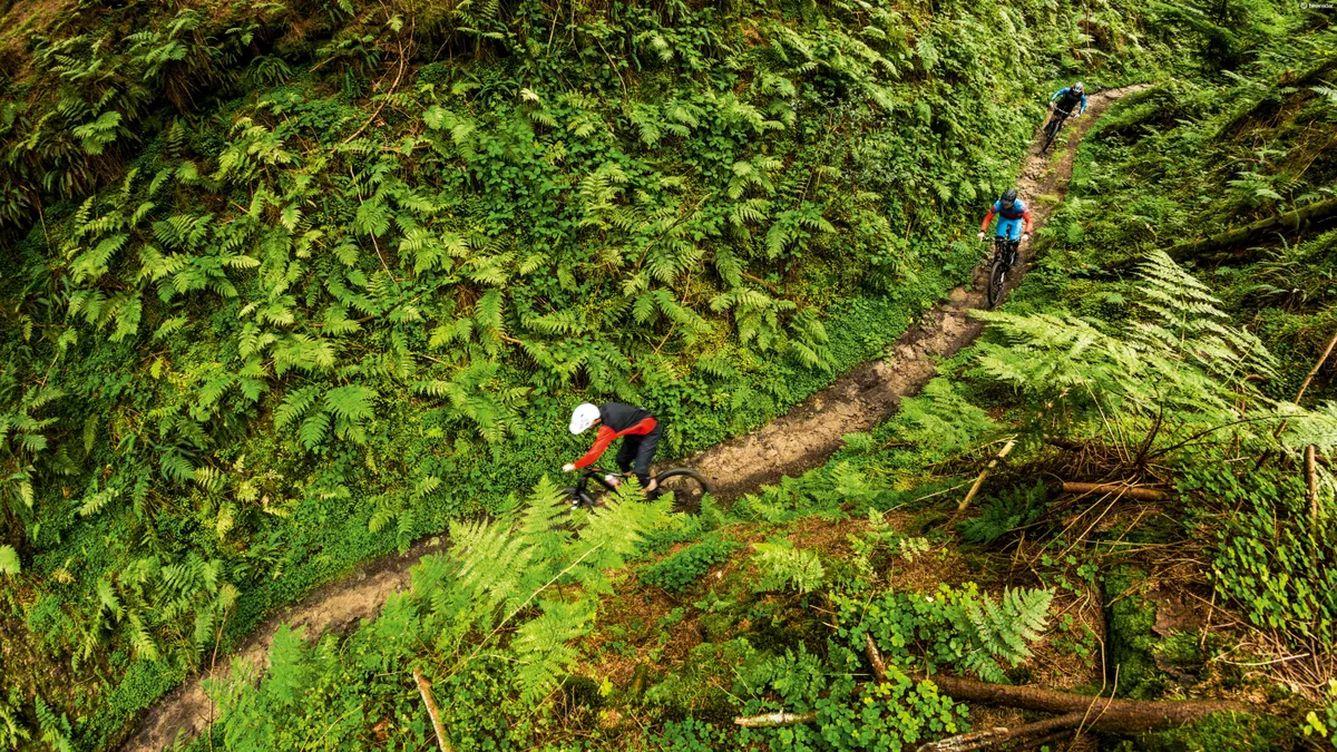
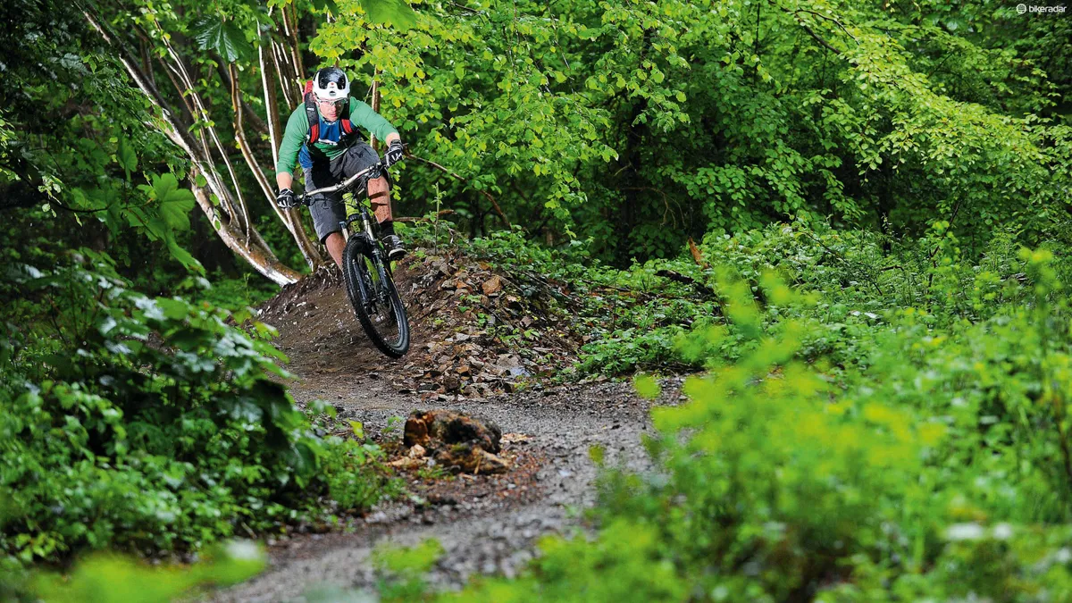
It's not difficult to see why we all love purpose-built trail centres so much: they're rideable whatever the weather, easily accessible throughout the UK and offer a good range of riding for different levels of ability.
We've gathered together all the essential info on the best trail centres England has to offer in an up-to-date list, including how to find them, what the trails are like and what facilities they offer.
- Best mountain bikes: the ultimate buyer's guide
- The best trail centres in Scotland
- BikeRadar's Bike of the Year Awards
Whether you're looking for a short, post-ride venue close to home or some technical riding at the weekend followed by a nice bit of cake, this guide will help you work out what's near you and what should be next on your trail centre tick list.
Most also have excellent facilities including bike shops for those last minute repairs and spares, and a trail hub with cafes, car parks and sometimes even showers.
Of course, there are plenty of excellent must-ride destinations in Wales, Northern Ireland and Scotland as well, so don't forget to check our our guides to those locations too.
So, whether you’re a seasoned pro or are just starting out in the wonderful world of mountain biking, you can discover some of the best places to go and ride your bike. Happy trails!
The best trail centres in England, as rated by our experts
- Ashton Court
- Cannock Chase
- Dalby Forest
- Forest of Dean
- Gisburn
- Grizedale
- Hadleigh Park
- Haldon Forest
- Hamsterly
- Kielder
- Stainburn
- Swinley Forest
- Whinlatter
- Sheffiled
- Sherwood Pines
Ashton Court
Ashton Court is just a 15-minute ride from Bristol city centre. It’s a great location for beginners because the riding isn’t steep or technical, though it’s fun to ride fast too.
The main blue route includes a short red-graded extension to practice your pumping and cornering. While you’re there you should also check out the second blue route just down the road in Leigh Woods, complete with a skills area and optional red sections. The two are great ridden together as a loop.
Who is it good for?
- Beginners: 3/3
- Intermediate: 2/3
- Advanced: 1/3
The trails
Nova, 6.5km (blue): The main trail is fairly flat but still has plenty of pump and flow. There are enough berms and hidden gems along the route to keep you entertained, but there’s nothing too technical or demanding. It’s great for beginners and perfect fitness training for more experienced riders.
Supernova, 0.8km (red): A short but sweet extension that’s packed with berms, jumps and rocky sections, ending with a more technical descent. It provides a good workout for the more experienced rider.
Further riding: Just down the road in Leigh Woods lies another blue trail, Yer Tiz. Approximately 5.5km long and of similar technicality to the blue at Ashton Court, it’s narrow and engaging as it snakes through the trees. Beginners can hone their skills by diverting onto a short skills loop or learn to catch air on a small row of new tabletop jumps built next to the car park.
How to get there
The Nova trail begins from the upper car park of the Ashton Court estate, accessed via the Clifton Lodge gate, which is just up the road from the Clifton Suspension Bridge.
- Grid ref: ST 558727
- Postcode: BS41 9JN (Ashton Court Mansion, not trails)
More info and facilities
- Useful links: www.bristoltrailsgroup.com and www.1sw.org.uk
- Facilities: Bike hire, bike shop, skills coaching, cafe, pay and display parking, toilets
- Nearest bike shop: Pedal Progression (on site), 01179 731298
Cannock Chase
Cannock Chase is home to two waymarked mountain bike trails that are free to ride and open all year round.
Situated in the middle of England, Cannock is easy to get to and very popular, so the two red XC routes — Follow the Dog and The Monkey Trail — can get very busy at weekends.
You can ride Follow the Dog on its own or combine it with The Monkey Trail to form a longer figure-of-eight route. The trails are maintained by Chase Trails, a volunteer group that works with the Forestry Commission.
Who is it good for?
- Beginners: 2/3
- Intermediate: 3/3
- Advanced: 2/3
The trails
Follow the Dog, 10.8km (red): (45mins–1hr30): Follow the Dog was the Midlands’ first dedicated MTB trail. It’s 75 percent singletrack and aimed at beginner to intermediate riders. The trail is a mixed affair; fast and flowing, with some tight and technical sections. You should be able to ride the whole thing in less than an hour but it’s entertaining enough to make a second lap worthwhile.
The Monkey, 22.8km (red): (including Follow the Dog, 2–3 hours): The start of The Monkey Trail is accessed via Follow the Dog. It’s more physically and technically demanding, with some trickier trail features and several black options. The trail is 80 percent singletrack and finishes with the awesome Lower Cliff descent.
Downhill area: Known as Stile Cop, this area boasts several DH runs. The tracks are only around a minute long but they’re packed with jumps, drops and other technical features that require commitment, so aren’t suitable for inexperienced riders.
How to get there
The cross-country trails begin at Birches Valley Visitor Centre. From Rugeley, take the A51 from the roundabout where it joins the A460 and head north towards Wolseley Bridge. At the first traffic lights, turn left onto Hagley Road and follow it out of town. Turn left by the Birches Valley sign, and left into the car park. For the downhill area, leave Rugeley on the A460 to Hednesford and turn left just outside town.
- Grid ref: SK 018171
- Postcode: WS15 2UQ
More info and facilities
- Useful links: www.chasetrails.co.uk
- Facilities: Bike hire, bike shop, cafe, pay and display parking, toilets
- Nearest bike shops: Swinnerton Cycles (on site), 01889 575170
Dalby Forest
Dalby Forest is one of the bigger trail centres in England. It’s got everything from green family trails to black-graded XC loops and a bike park area.
The 34.3km red trail is a big undertaking, but it can be split into three distinct sections that can be ridden on their own, or with green and blue options to take you back to the start point if you don’t fancy the whole thing, and it gives you the option to hit the awesome new blue graded descent, which was completed last year.
Volunteer builders Singletraction have also been busy at Dixon’s Hollow Bike Park, recently completing a new pump trail/skills area. If you fancy a weekend trip to the area, try out Sutton Bank trail centre too, which is just 26 miles away.
Who is it good for?
- Beginners: 3/3
- Intermediate: 3/3
- Advanced: 2/3
The trails
Green trails and skills areas: Ellerburn family cycle route 4.7km, Ellerburn skills area 300m, Adderstone cycle trail 12.4km.
Blue trail, 12.8km (1–2 hours): This route combines easy singletrack with open terrain and some steep sections. An awesome new descent of swooping berms and rollers opened last year.
Red trail, 34.3km (3–4 hours): The red trail can be started from either Low Dalby or Dixon’s Hollow car park. It’s a long trail with lots of varied singletrack, and can be made into three separate routes by combining other blue and green trails. These also make good shortcuts if the full distance is a bit of a challenge for you.
World Cup XC, 6.4km (black, 1 hour): This strenuous pro-level track is best ridden while imagining you’re racing 30 other guys or gals. It’s a bolt-on to the red trail and includes challenges such as the infamous Worry Gill and Medusa’s Drop.
Dixon's Hollow bike park: One for adrenaline junkies, with a 4X track and a jump line. A new 600m long blue graded pump trail/skills area opened in April this year.
How to get there
Dalby Forest is on the edge of the North York Moors National Park. It’s situated just off the A169 from Pickering to Whitby, turning right just before the Fox and Rabbit Pub onto the Thornton-le-Dale road. The turn-off for the forest drive is on your left after a short way. Follow the brown tourist signs when approaching Dalby.
- Grid ref: SE 857873
- Postcode: YO18 7LT
More info and facilities
- More info: www.forestry.gov.uk/dalbyforest
- Facilities: Bike hire, bike shop, bike wash, visitor centre, cafe, toilets, parking
- Nearby bike shop: Dalby Bike Barn (on site), 01751 460049
Forest of Dean
Just over the border from Wales, Gloucestershire’s Forest of Dean is a popular place to ride. It’s full of great trails and there’s a buzzing atmosphere at the trail-head too. There’s a mix of wide forest tracks, marked XC routes and plenty of DH trails to test your skills.
The red-graded Freeminer Trail was extended last year and the downhill tracks have just seen a bit of a revamp, with the addition of a skills area and a big pump track.
The downhill trails are easily accessed via the uplift service or a fire road push-up, and the regular Mini DH and enduro events are a great way to cut your teeth racing. What’s more, the forest is full of great off-piste singletrack too, if you know where to look.
Who is it for?
- Beginners: 3/3
- Intermediate: 3/3
- Advanced: 3/3
The trails
Family trail, 17.5km (green): This smooth and relatively flat route is perfect for families with little kids, and the Forest of Dean in general is a very family-friendly location. At the weekends, there are regular children's club rides, with lots of child and youth races on offer too.
Verderers trail, 11km (blue, 1–2 hours): Packed with switchback climbs and beautiful berms, and with an exciting final descent, the Verderers’ may be ‘just a blue’ but it’s great fun whatever level you are. Beginners can enjoy the flow and hone some skills, while experts can push their limits.
Freeminer trail 11km (red, 30min to 1 hour): This trail is really varied, with tight singletrack and tricky climbs, drops and berms. The newest section of trail contains some more natural-feeling rooty singletrack, where line choice is critical. The Dean Trail Volunteers work super hard to ensure that all the trails are kept in good shape, so help them out with some elbow grease or a donation if you can.
Downhill tracks: There are seven marked runs in total, all of which take a couple of minutes to get down. They range from the berms and drops of GBU to the twisty goodness of Mr Rooty and Corkscrew. The slick uplift service operated by FlyUp Downhill offers a quick turnaround, or you can push up if you prefer.
How to get there
The XC routes and DH trails are all accessed from the Cannop Cycle Centre, home to the Pedalabikeaway shop and cafe, just off the B4234.
- Grid ref: SO 607126
- Postcode: GL16 7EH
More info and facilities
- More info: www.fodmtb.com and www.flyupdownhill.co.uk.
- Facilities: Bike hire, bike shop and workshop, bike wash, cafe, pay & display parking, showers, toilets, uplift service, suspension tuning
- Nearby bike shop:Pedalabikeaway (on site), 01594 860065, Dean Forest Cycles (three miles away), and Sprung Suspension Workshop (on site), 01594 800910.
Gisburn
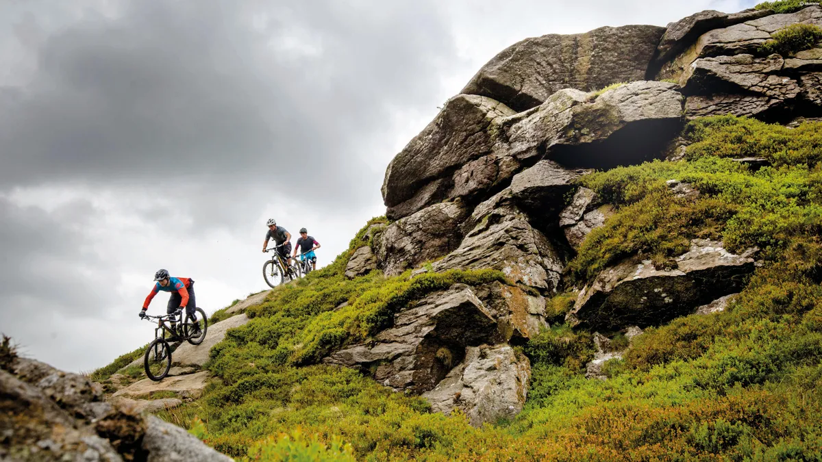
Gisburn lies in the Forest of Bowland, a designated Area of Outstanding Natural Beauty, so you’re guaranteed some amazing scenery as you enjoy the trails.
There’s an easy blue route and a slightly harder and longer red XC route, neither of which will leave you feeling disappointed. Both start from the Gisburn Forest Hub car park, where you’ll also find a cafe and skills loop. Further into the forest there are two downhill trails with berms, jumps and drop-offs.
If you fancy challenging yourself, why not take on the Forestry Commission’s Super Six challenge? This involves riding the six most northerly English trail centres: Kielder, Chopwell, Whinlatter, Hamsterley, Grizedale and Gisburn.
Who is it for?
- Beginners: 2/3
- Intermediate: 2/3
- Advanced: 2/3
The trails
Bottoms Beck, 9.5km (blue, 1.5–2hrs): This is a nice, short and easy ride that’s suitable for novices. The trail has a good combination of forest road and singletrack as it follows an old railway line. That doesn’t mean it’s straight though — you’ll twist and turn through Park Wood before finishing back in the car park with a big grin on your face.
The 8, 18km (red, 1.5–3hrs): The 8 trail is a really fun loop that takes in a wide variety of terrain, from dark, twisting woodlands, to wide open moorland. The landmark point of the ride is Whelpstone Crag and there’s great technical rock features to ride around there as well as some stunning views. It’s worth trying the optional black line of Hully Gully too, which is a unique descent of big wall-ride berms.
Bike park, 0.5km: Hope Line and Leap of Faith are twisty DH trails that are under continuous development and maintenance by trail volunteers. Both trails are in the heart of the forest, about 3km from the Gisburn Forest Hub.
How to get there
Gisburn Forest Hub is near Slaidburn. Turn off the B6478 onto Dugdale Lane, then follow a wiggle of minor roads to the car park.
- Grid ref: SD 745560
- Postcode: Slaidburn BB7 4TS
More info and facilities
- More information:www.forestry.gov.uk/gisburn and www.gisburnbiketrails.com
- Facilities: Cafe, toilets, pay and display parking, small shop with a few essentials like inner tubes
- Nearby bike shops: ATR Cycles, Clitheroe, 01254 825896; Pedal Power, Clitheroe, 01200 422066; and the Escape Bike Shop, Ingleton, 01524 241226
Grizedale
The Lake District is a mountain biking hotspot, with some of the best natural trails the UK has to offer.
Grizedale is slap bang in the middle between two beautiful lakes, Coniston Water and Lake Windermere. It’s got some serious elevation, which gives panoramic views over Helvellyn and beyond.
The forest is famous for its outdoor sculptures, many of which can be viewed from the tamer trails. The red-graded North Face loop is perfect for intermediate riders who want an enjoyable but not overly technical singletrack ride. There’s also a short black trail full of jumps, berms and steep descents, with a double-black-diamond option that’s not for the faint-hearted.
Grizedale is part of the Forestry Commission Super Six (see Gisburn above).
Who is it for?
- Beginners: 2/3
- Intermediate: 3/3
- Advanced: 2/3
The trails
Goosey Foot Tarn, 3.5km (green)
Grizedale Tarn Trail, 10km (blue)
Mushroom Trail, 11km (blue)
Moor Top Trail, 11.5km (blue)
Hawkshead Moor Trail, 17km (blue)
Silurian Way, 23.5km (red)
The North Face, 16km (red): The North Face trail is an entertaining route, which is ridable by less experienced bikers yet also a lot of fun for better riders. It has some leg-burning climbs, which will test your uphill strength as much as the downhills test your skills. There are some high-speed sections, boardwalk, rocks and an optional 1km black stretch that can be ridden as part of the red route or on its own.
How to get there
Head north out of Hawkshead, turn right up a tiny lane signposted to Grizedale and the trail centre is two miles down the road.
- Grid ref: SD 331944
- Postcode: LA22 0QJ
More info and facilities
- More info: www.forestry.gov.uk/grizedale
- Facilities: Bike hire, bike shop, cafe, pay and display parking, toilets, visitor centre
- Nearby bike shop: Grizedale Mountain Bikes (on site), 01229 581116,
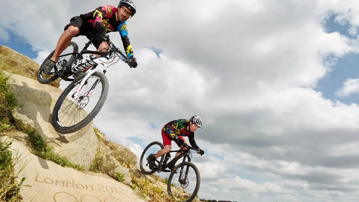
Hadleigh Park
Hadleigh Park in Essex carries the London 2012 legacy on its shoulders — ride here and feel like an Olympic athlete! After the Games, the XC racetrack was adapted for the public and split into blue, red and black graded sections, meaning there’s something for everyone.
As you’d expect, the trails are well planned and built, and ridable in all weathers. It’s an easily accessible location with great facilities, but don’t come here expecting airtime or long descents. This is pure-bred XC territory, so bike up accordingly and you’ll have a great time.
Who is it for?
- Beginners: 2/3
- Intermediate: 2/3
- Advanced: 1/3
The trails
2012 Olympic CX track 5km: Designed to test the best athletes in the world, the Olympic cross country course contains almost 1.7km of climbing per lap as well as a number of sharp technical descents. Riding it fast is a real test of fitness, and taking on the optional black lines, such as Deanes Drop and The Leap of Faith, will challenge your skills and nerve too.
Being split into blue, red and black sections, it gives beginners and intermediate riders an idea of what they might expect to find. Several sections of the red trail have been re-built and spruced up, so it should be in prime condition. There’s also a skills area to warm up in, as well as a pump track.
How to get there
Leave the M5 at junction 30 and follow the A13 towards Southend-on-Sea. In Hadleigh, turn down Castle Lane to the visitor centre.
- Postcode: SS7 2PP
More info and facilities
- More info: www.hadleigh-park.co.uk
- Facilities: Bike hire, bike shop and workshop, cafe, toilets, coaching, pay and display parking
- Nearby bike shops: Bike Art (on site), 01702 551076; Cycles UK, Leigh-on-Sea, 01268 74828; and Richardsons Cycles, Leigh-on-Sea, 01702 713847.
Haldon Forest
It may be just a stone’s throw from the M5, but this woodland mountain bike sanctuary succeeds in making you feel like you’ve been transported to deepest, darkest Devon.
There are several waymarked trails, as well as some off-piste singletrack if you know where to look. The red-graded Ridge Ride begins with a flat and then downhill start, at odds with many UK trail centres. It’s great fun but make sure you’re warmed up first — you can do this in the skills area by the car park.
Who is it for?
- Beginners: 3/3
- Intermediate: 2/3
- Advanced: 1/3
The trails
Discovery, 2.4km (green): A well-surfaced route for beginners and families. Walkers use this trail too, so be aware.
Spicers, 3.7km (blue): This trail is one step up from the green, with some narrower sections and gentle gradients.
Kiddens, 6.4km (red): The next progression from the Spicers trail. There are greater challenges here, in terms of both gradient and terrain.
Ride Ride, 9.6km (red): This would be more aptly described as a pink trail rather than a red. The not-too-difficult singletrack that weaves through the trees is fun and flowy, and the downhill start away from the car park is a welcome change too. There’s a black-graded 1km option, the Ridge Ride Extreme, which is a technical loop with more difficult trail obstacles.
Skills/pump track: The skills area is designed to give a taster of the features you’ll find out on the marked trails. The pump track is a decent length and lots of fun.
How to get there
The centre is just off the A38 near Exeter racecourse. Follow the brown tourist info signs to the car park.
- Grid ref: SX 884849
- Postcode: EX6 7XR
More info and facilities
- More info: www.forestcyclehire.co.uk and www.forestry.gov.uk/haldonforestpark
- Facilities: Bike hire, bike shop and workshop, guiding, cafe, toilets, pay and display parking
- Nearby bike shops: Forest Cycle Hire (on site), 01392 833768
Hamsterley
On the edge of the wild North Pennines, the trails at Hamsterley Forest are cut into a steep-sided valley hidden in 2,000 hectares of woodland. There are three XC routes, totalling more than 30km of flowing singletrack and a playground of downhill trails. Combining the two flavours of riding makes for an exciting and varied place to ride.
The big news is that The Descend Bike Park has been taken over by the World Champion downhill racer Danny Hart and the trails here have played no small part in his success.
Who is it for?
- Beginners: 3/3
- Intermediate: 3/3
- Advanced: 3/3
The trails
The Loop Skills Area, 1.6km: Put your skills to the test, warm up before riding, or just play about sessioning features.
Blue, 14.5km (1–2hrs): A wide route that uses purpose-built cycle trails, forest roads and the tarmac forest drive to explore the forest itself.
Red, 23.5km (2–3hrs): This is a longer, harder version of the blue trail taking you to further reaches of the forest on a mixture of fireroads and singletrack. There are superb views at the top, overlooking Eggleston Moor. The trail follows a figure-of-eight route, crossing over itself at The Grove car park. It passes the aforementioned Descend Bike Park if you fancy a few laps.
Black, 13km (1–1.5hrs): The black trail is both strenuous and technically challenging. It combines steep, technical climbs, smooth singletrack and great rooty descents into a natural feeling route.
Descend Bike Park: The five DH tracks are tough and technical, with steep rock chutes, berms to rail and jumps of all sizes. There’s a great 4X course too.
How to get there
From Durham, head south on the A690 towards Crook. Stay on this road as it becomes the A689 at Crook, and turn left at the roundabout junction with the A68. Head for Darlington and turn right after three miles, following signs for Hamsterley.
Once in Hamsterley turn right into the centre, cross the river and go left up the forest drive. The bike park has its own car park, go through Hamsterley village and look out for it on the right after three miles.
- Grid ref: NZ 092312
- Postcode: DL13 3NL
More info and facilities
- More info: www.hamsterley-trailblazers.co.uk, www.forestry.gov.uk/hamsterleyforest and www.descendbikepark.co.uk
- Facilities: Bike hire, bike shop, cafe, pay and display parking, toilets
- Nearby bike shops: Wood N Wheels (on site), 03338 008222
Kielder
Sitting in the middle of a massive forest, the man-made trails at Kielder are a solid addition to the region. The paths have plenty of singletrack, a few tough climbs and some technical riding.
The trails
Osprey, 20.5km (blue, 2–3hrs): Osprey is an open, flowing trail designed for riders who love a good cross-country blast
Lonesome Pine, 19.7km (red, 2–4hrs): If you like views, you’re in for a treat. On Lonesome Pine you can see for miles. The trail also has one of the UK’s longest sections of North Shore woodwork.
Bloody Bush, 33km (red, 3–6hrs): The combination of Lonesome Pine and Bloody Bush gives an impressive 33km of red-graded trail riding. Bloody Bush speeds through trees and moorland all the way to the Scottish border and the 7stanes trail centre at Newcastleton.
Deadwater, 6.8km (red, 1–2.5hrs): An enjoyable route with descents, berms and forest singletrack.
Up and Over, 10.2km (black, 1–2.5hrs): The black branches off the Deadwater red route (so take into account you'll need to factor in time to ride that too), adding a tricky climb and technical downhill.
How to get there
From Newcastle or Carlisle, follow the A69 to Hexham, then the B6320 to Bellingham (signed Kielder Water and Forest), then the C200 to Kielder Water and Forest Park. From Jedburgh or south-east Scotland, take the A68 south then the B6320 from Otterburn to Bellingham. Follow the brown signs to Kielder Water and Forest Park. From south-west Scotland, follow the A7. Leave the road at Canonbie to join the B6357 to Newcastleton, and Kielder Water and Forest Park is signposted from there.
- Grid ref: NY 632936
- Postcode: NE48 1HX
More info and facilities
- More info: www.kieldertrailreavers.org.uk and www.forestry.gov.uk/kielder
- Facilities: Bike hire, bike shop, cafe, parking, toilets, camping, youth hostel
- Nearby bike shops: The Bike Place
Stainburn
Stainburn claims its black route is the most technical man-made cross-country trail in England. Built mainly by trail builder extraordinaires SingletrAction, Stainburn’s trails aren’t long — it’s the sort of trail centre where you come to session sections until you can ride them clean.
The trails
Red trail, 2km (15–30mins): Stainburn’s shortest and easiest route. It swoops down from the car park and climbs through a rock garden into the woods. Then there are switchbacks, low berms and jumps.
Descent Line, 1km (red, 5 mins): Turning off at the top of the red route, the Descent Line snakes through the woods, around tight corners and out into the open. A few fast berms and some high-speed rock sections lead you on to two sizeable drops.
Norwood Edge, 3.2km (purple, 30mins–1.5hrs): This might be a short XC route, but it’s quite technical — if your bike handling skills or fitness are lacking, it’ll show!
Warren Boulder Trail, 4km (black, 30mins-–1hr): Think you’re a good rider? Find slick slabs a doddle? Reckon steep rock gardens are easy? Know you can balance along boulder-spines and ride North Shore without problems? Got strong legs and technical climbing skills? Good, you’ll need all this and more to get round Stainburn’s black route!
How to get there
From Harrogate, take the A59 west towards Blubberhouses. After seven miles, turn left onto the B6451, signposted to Otley. The car park is on your right after about three miles.
- Grid ref: SE 210509
- Postcode: Otley
More info and facilities
- More info: www.singletraction.org.uk
- Facilities: Parking (and that's pretty much it!)
Swinley Forest
Just a stone’s throw from London and a lesson in balancing leisure interests (there’s a Go Ape! ropes course here too, as well as plenty of walkers), Swinley Forest is evolving as a trail centre.
Green, blue and red XC routes totalling 24.2km have been built thanks to investment from The Crown Estate and some new sections have been added on to the red trail in the last year.
A freeride area is also in the pipeline and will hopefully be completed by late 2017. Why not check out the trails on one of the group rides organised by Swinley Forest Hub, after which you can enjoy one of their infamous BBQs.
Who is it for?
- Beginners: 2/3
- Intermediate: 3/3
- Advanced: 2/3
The trails
Green trail, 1.2km (20–30min): The Green is a typical wide family trail but with two 25m loops that are twisty, fun and suitable for very small wheels!
Blue trail, 10.1km (1–1.5hrs): This is a sweeping bermed trail that makes the most of its limited elevation gain. All the features are rollable so it’s a great route for beginners, but when ridden at speed it’s still a good laugh for more experienced riders.
Red trail 13km (1–1.5hrs): Accessed straight from the blue trail, the red contains some more technical singletrack plus a couple of downhill sections that are a real hoot, such as Tank Traps and Deer Stalker. Combine the blue and red routes for a great loop that’ll make you smile, whether you’re a beginner or a seasoned shredder
How to get there
All the new trails start at The Look Out Discovery Centre. It’s off the A322, which runs between the M3 (Junction 3) and the M4 (Junction 4). Follow the brown tourist signs to The Look Out and Coral Reef. Turn off the A322 on to Nine Mile Ride (B3430) at a roundabout about four miles up from the M3. The Look Out is on your left after about 100m.
- Grid ref: SU 876661
- Postcode: RG12 7QW
More info and facilities
- More info: www.swinleybikehub.com, www.thecrownestate.co.uk and www.bracknell-forest.gov.uk/leisure-services/look-out-discovery-centre
- Facilities: Bike hire, cafe, pay and display parking, toilets, coaching, rental
- Nearby bike shops: Swinley Bike Hub
Whinlatter
Lying to the west of Keswick in the Lake District, Whinlatter Forest is a great spot. It contains the blue-graded Quercus Trail and the figure-of-eight Altura Trail. The Altura trail also features optional black sections and exhilarating descents. The blue route is great fun to ride fast.
The trails
Quercus trail, 7.5km (blue, 1.2hrs): The blue Quercus trail is for reasonably competent cyclists and mountain bikers, but there are easy routes around technical features such as berms and rock paving. It’s a short but twisty loop and is an absolute blast when ridden fast.
Altura trail, 19km (red, 1–2hrs): The Altura trail has two loops, the North and the South. The North has optional black sections and 200m height gain, rewarded by exhilarating descents. The South boasts fast singletrack with berms, jumps and natural features to challenge you — also in return for a hefty climb. Take it steadily or hit with a bit more speed to add a massive dose of fun.
How to get there
From Keswick, take the A66 west towards Cockermouth. After a couple of miles, enter the village of Braithwaite and turn left onto the B5292. Follow the road through the village and into Whinlatter Forest. The car park and visitor centre are on your right.
- Grid ref: NY 209245
- Postcode: CA12 5TW
More info and facilities
- More info: www.forestry.gov.uk/whinlatterforestpark and visitlakelandforests.co.uk
- Facilities: Bike hire, bike shop, bike wash, cafe, pay and display parking, shop, toilets, visitor centre
Sheffield
The Steel City is a hive of MTB activity, with advocacy group Ride Sheffield using the collective might of the riding community to preserve, improve and promote access for mountain bikers. There are three distinct areas, all close to the city, that are worth checking out, with everything from mellow blue trails to challenging descents. There are also some techy DH trails in Wharncliffe Woods on the opposite side of the road to Greno Woods, but we recommend going with a local for the first time as they can be tricky to find.
Who is it for?
- Beginners: 2/3
- Intermediate: 3/3
- Advanced: 3/3
The trails
Lady Cannings Plantation, 1.4km (blue): This rollercoaster trail is suitable for all abilities, with no jumps to put off beginners. A second blue trail opened in Easter 2017 and a red graded descent is planned for 2018 by the nearby Redmires Reservoir.
Parkwood Springs, 2km (blue): Right near the centre of town, this blue trail with red-graded options has classic flow, with lots of berms, jumps and rollers. There’s also a dual slalom track, so assemble some mates for some head to head action.
Greno Woods (red): Steve Peat’s training ground has two red graded descents, Pub Run and Steel City, and one black DH run, DH3. These are connected by a bridleway to get you back to the top of the hill.
How to get there
- Grid ref: SK 325950
- Postcode: S35 8RS for Greno Woods, S11 7TU for Lady Cannings, S5 8XB for Parkwood Springs
More info and facilities
- More info: www.ridesheffield.org.uk
- Facilities: Parking
- Nearby bike shops: Bike Rehab, city centre, 0114 4388 506 and JE James, near Lady Cannings, 0114 255 0557
Sherwood Pines
Sherwood Pines Forest Park mustn’t be confused with Sherwood Forest – there’s much more riding at the former. Fast woodland singletrack is the order of the day, with a couple of purpose-built XC loops, over 45km of unmarked trails (keep your eyes peeled!), a skills area and a bike park complete with a set of dirt jumps. The centre sits right on National Cycle Network Route 6 so it’s easy to get to by bike.
Who is it for?
- Beginners: 3/3
- Intermediate: 3/3
- Advanced: 2/3
The trails
Family, 4.8km (green): As the name says, this is an easy family trail. It can also be accessed from the nearby Center Parcs holiday park.
Adventure, 9.6km (blue): Twice the length of the family trail but not anymore technical, this route uses the green trail and the nearby NCN route to take riders deeper into the forest.
Kitchener, 12.8km (red): Named after the famous field marshal of World War I ‘Your country needs you!’ recruiting poster fame, this flowing, twisty singletrack trail is great fun and a challenge to ride at speed. It’s a great introduction for riders wanting to progress onto trickier trails. Look out for some ‘hidden’ off-piste singletrack too.
Bike Park, 0.8km: The bike park has two very different sections – the dirt jump area and the downhill zone. The dirt jumps are a series of graded jumps with a warm-up section. The DH zone contains technical features and challenging terrain, with a number of interlinking descents that criss-cross their way down the hillside.
How to get there
From Mansfield take the A6030, following signs for Clipstone and Ollerton. Go past these places and under the railway bridge, and Sherwood Pines is well signposted.
- Grid ref: SK 612637
- Postcode: NG21 9JL
More info and facilities
- More info: www.forestry.gov.uk/sherwoodpines
- Facilities: Bike hire, bike shop, pay & display parking, toilets
- Nearby bike shops: Sherwood Pines Cycles (on site), 01623 822855
The information in this article is taken from Britain’s 50 Best Trail Centres, free with issue 343 (June 2017) of Mountain Biking UK magazine, available on Apple Newsstand and Zinio.