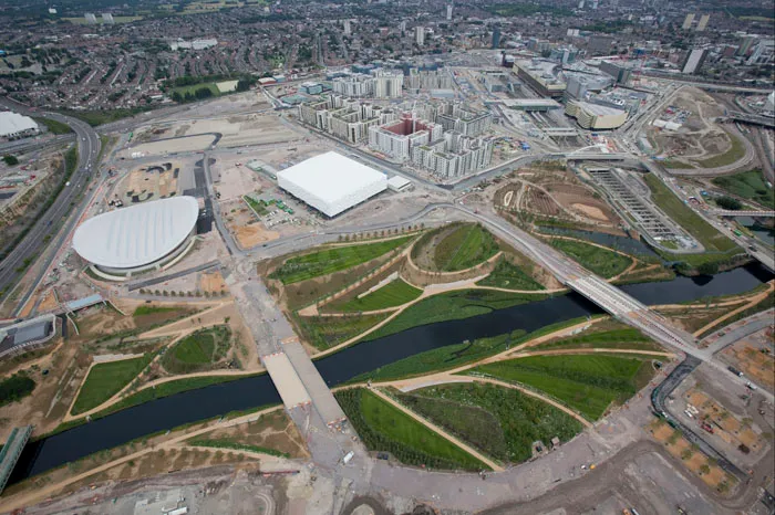
Olympics Route Legacy Under the Spotlight
A recent article in London Cycling Campaign magazine by Tom Bogdanowicz looked at the mystery of exactly what cycle routes will be left at the 100 acre Queen Elizabeth Olympic Park once the razzmatazz of the games has departed.
Bogdanowicz, campaigns and development manager at LCC, highlighted the difficulty they were having getting concrete information on the routes and what was currently planned, saying "LCC Olympic group members have been trying to follow and influence the complex and elusive plans and negotiations over this valuable real estate."
LCC believe the park and the surrounding Lea Valley area has massive cycling and recreational potential: "Thousands of Londoners pay hard cash to ride and swim in UK resorts like Centre Parcs. Yet in nearby East London they may be able to get the same exercise and enjoyment for free - that is if local authorities, the Olympic Park Legacy Company and Transport for London can collaborate and deliver what's needed."
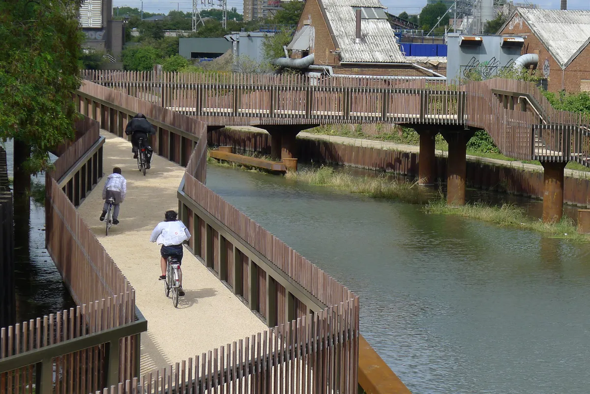
LCC highlight some of the new routes in and around the park that will be a boon for cyclists - for example the new 'missing' towpath link at Bow and several miles of off-road tracks within the park. They also point to worrying question marks over the details that have emerged. The apparent aim for travel to the park, once the Olympics have gone, will be a mere 5-7% of all journeys which is "...much lower than the potential of such an ideal greenfield site."
They also point to the potential barrier of a four lane road through the park to a shopping centre in Stratford and the apparent lack of a safe and convenient cycle route from Stratford centre to the park.
Watch this space as more details emerge.
New routes in the UK
New cycle route route alongside world's longest guided bus route
The long-awaited traffic-free railpath route between St Ives and Cambridge - all 20 miles of it - is now open. It passes through fine countryside as well as passing next to many villages and Cambridge Science Park. Also nearby at St Neots is the longest bridge to be built on the National Cycle Network at 560m, crossing the floodplain of the River Great Ouse.
South-East
A new 35 mile signed road route between Quendon and Ulting in Essex in is now open, signed as Regional Route 50.
South-West
A new interactive map - the South West Adventure Cycle Map - is a very handy resource for off-roaders with routes identified by difficulty and also photos of the actual trail condition, plus lots more info.
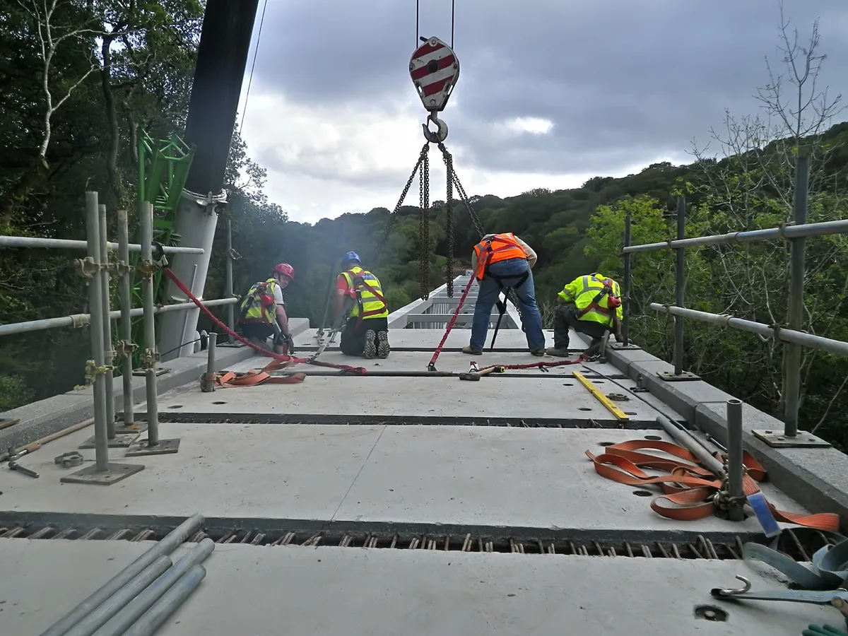
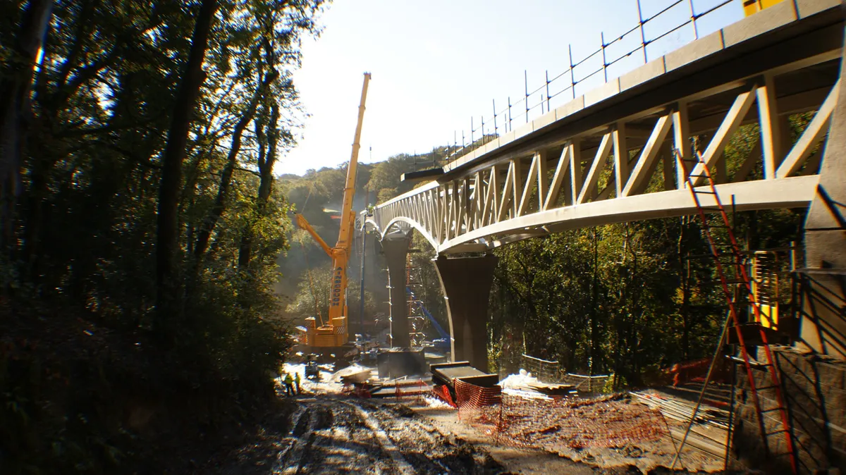
Work is progressing on the popular Devon Coast to Coast’s Gem Bridge – a 200-metre long, £2.1 million cycle and pedestrian bridge across the Walkham Valley near Tavistock – it’s on track for a Spring 2012 opening.
Northern Ireland
Now open and 310 metres bank to bank across the River Foyle, the £15 million Peace Bridge gives pedestrians and cyclists around Derry access to a developing network of greenways.
Scotland
What Sustrans describe as one of their biggest engineering projects ever undertaken in Scotland continues with a section of path between Creagan and Inverfolla completing a 13-mile stretch route stretch is now available from the Sea Life Sanctuary (north of Oban) to the Highland boundary at Dalnatrat. Route map available locally.
Wales
Angelsey’s Copper Trail is now open, linking Llanerchymedd, Amlwch, Cemlyn Bay and Llynon Mill and using mainly minor roads.
New routes in the US
Mountain bikers have trailblazed a new, spectacular looking and largely singletrack 480 mile MB route through Virginia's Allegheny and Blue Ridge mountains. Their route linked eight major trail systems in the George Washington and Thomas Jefferson National Forests and climbed 65,000 feet over the course of 12 days. Look out for more details of this one in 2012.
New maps & guides
New Series of Maps from Sustrans £4.99 each
Sustrans have just launched a new series of area-based pocket guides to the National Cycle Network. They use 1:110,000 scale mapping with detailed town and city inserts. They are ideal for leisure cyclists who want to avoid traffic, colour coding off-road tracks and quiet lanes as well as the NCN. The first two in the series cover the Thames Valley and the Severn & Thames areas with several more to follow covering the south-east.
From: Sustrans
Cycling in the Netherlands £13.99 Publisher: Cycle City Guides ISBN: 978-1900623193
A great guide, not only for the comprehensively mapped and described 340km circular route of many of the Netherlands' main sights, but also for the insight into cycling culture by the author and bona fide Dutchman, Eric van der Horst. The traffic-free cycling motorway through the dunes sounds unmissable.
From: Cordee
Cycle London £12.99 Publisher: Time Out ISBN: 978-1846702365
There are already several guides out to cycling in London but this one has the 'Official' tag of the Olympic and Paralympic games awarded to it - whatever this means. It's a good value guide with large street-level mapping and written by very experienced London cyclists who should know the routes inside out and covers rides from 2.9 to 43 miles for all levels of rider.
The only really disappointing feature is the format - not spiral-bound to fit in pockets or map folders and with directions spread out over several pages.
From: Good bookshops