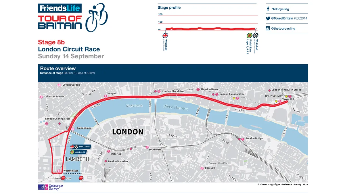
Ahead of the start of the Friends Life Tour of Britain on 7 September, Ordnance Survey, official mapping partner of the race, have released full route details including downloadable GPX files for on-the-bike navigation.
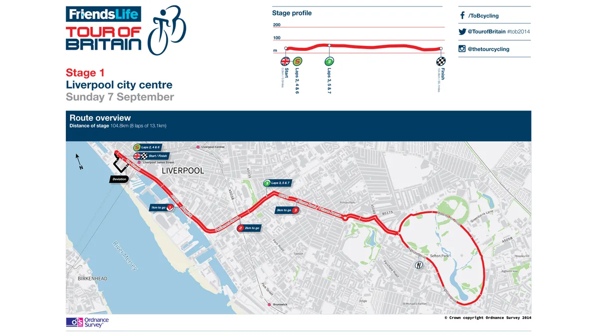
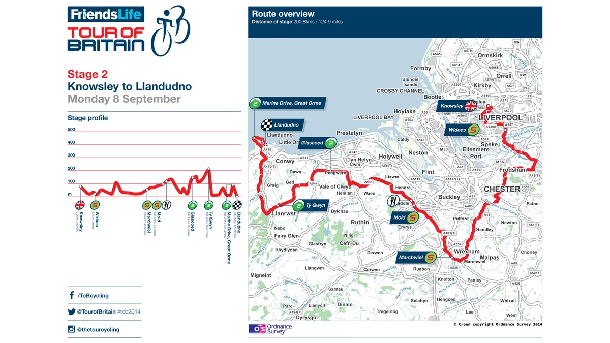
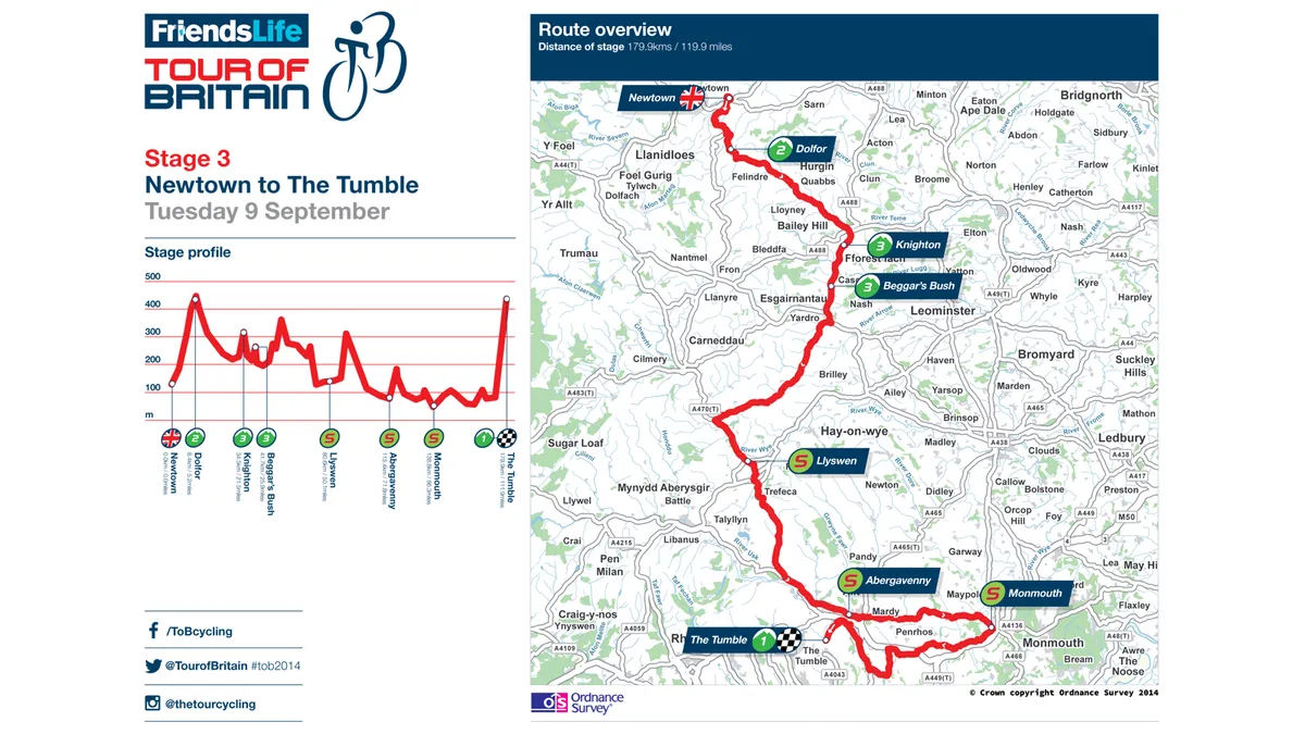
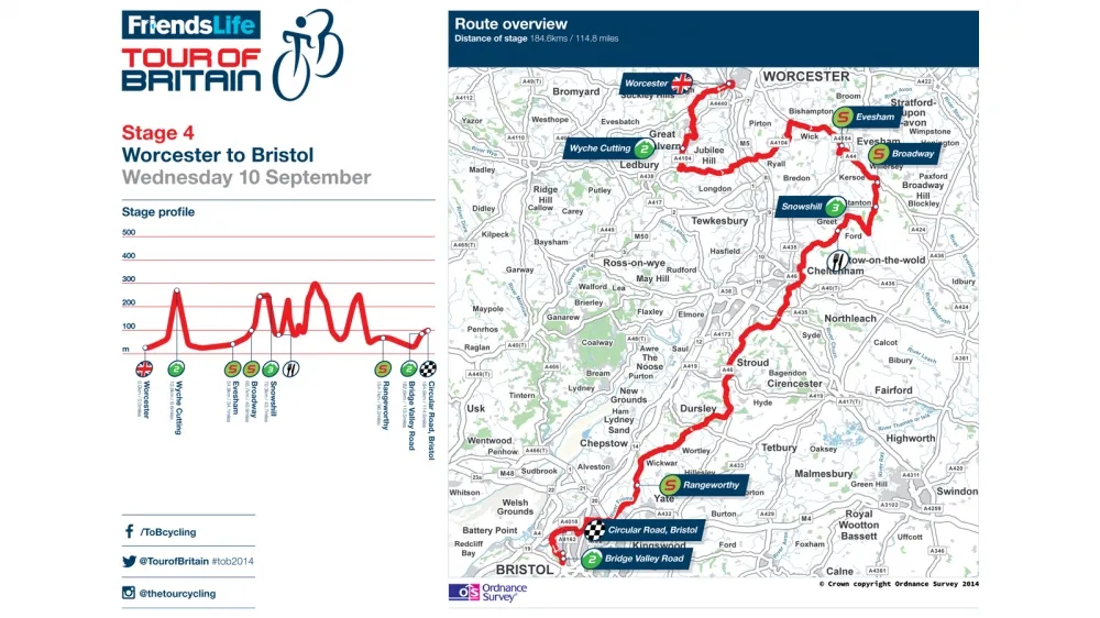
Each of the nine stages – running from Liverpool on Sunday, 7 September to London on Sunday, 14 September – are individually detailed by OS, and include YodelDirect Sprint and Skoda King of the Mountains climbs.
Managing director of Ordnance Survey, Nick Giles, said: "We have created a complete mapping package for the Friends Life Tour of Britain allowing cyclists and fans to either download and print route maps, view the stages via interactive online OS maps or export GPX files of the stages for mobile devices."
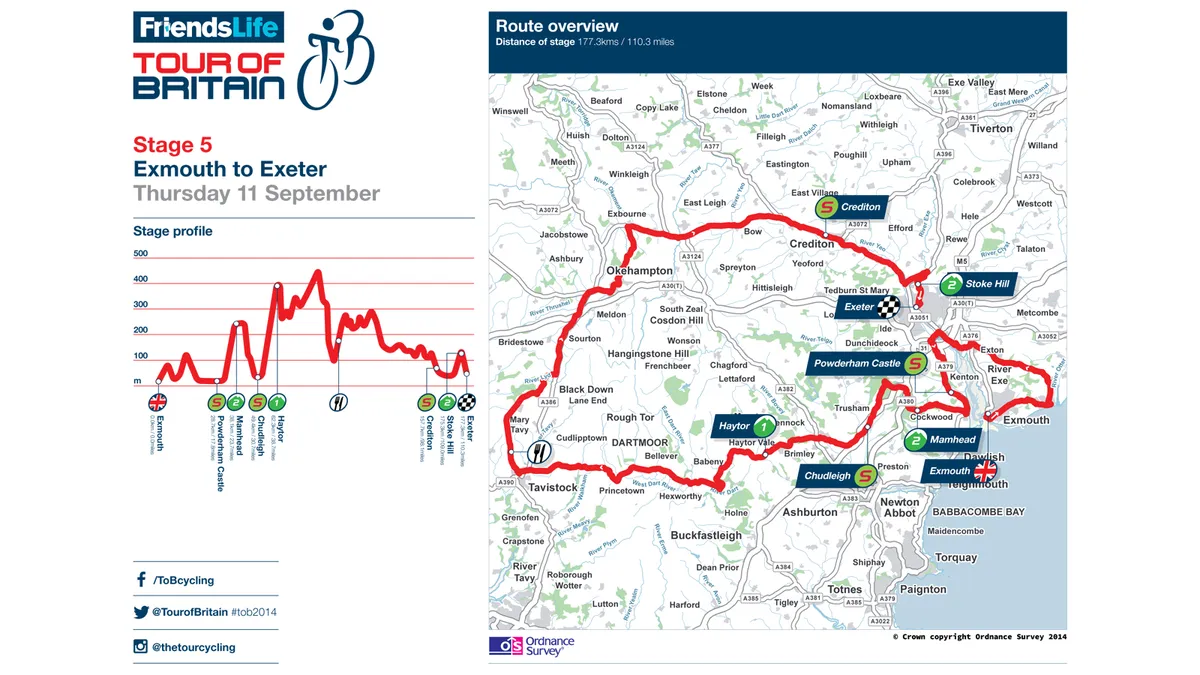
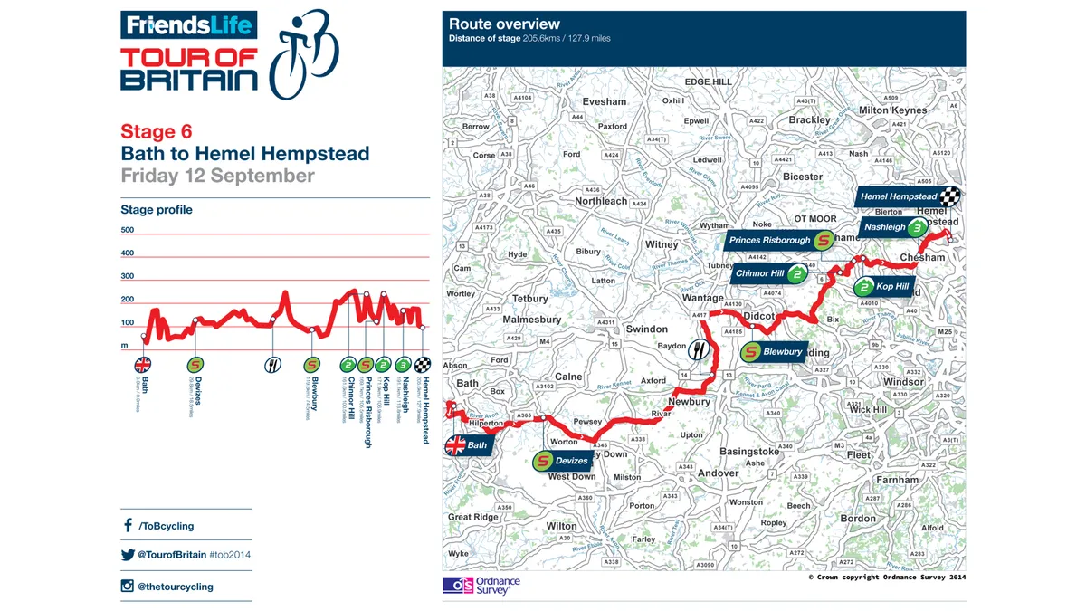
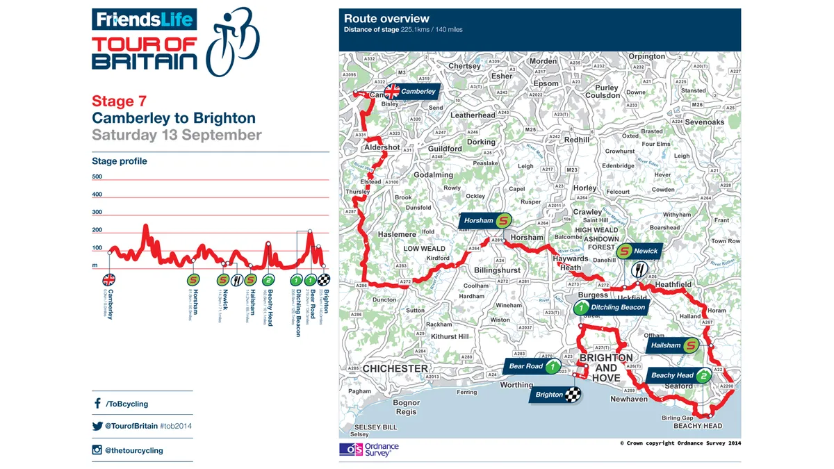
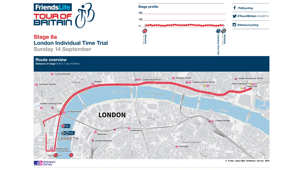
The GPX versions of the routes, which include stages across the UK including Llandudno, Newtown, the Tumble, Worcester, Bristol, Exeter, Bath, Hemel Hempstead and Brighton, are also compatible with Ordnance Survey’s OS MapFinder app, which displays multiple scales, and the company’s OS Ride app, which gives on-the-bike routing following the Tour of Britain courses.
Visit the Ordnance Survey website for more on the Tour of Britain routes.