

UK cyclists are set to benefit from the construction of numerous new pedestrian/cycle bridges over the next year or two, many of which are being put up as part of Sustrans' Connect 2 scheme, which includes the country's largest bridge-building project for over 150 years.
Work is about to begin on a 350m span bridge at St Neots, Cambridgeshire, across the River Great Ouse. The budget is £3.5 million and work is expected to be complete by late summer 2011.
Exeter in Devon will also soon see the arrival of a major new cycle and pedestrian bridge over the M5 east of the city, linking to the village of Clyst St Mary. There will also be new cycle signs and signals at junction 30 of the M5.
New routes
Devon
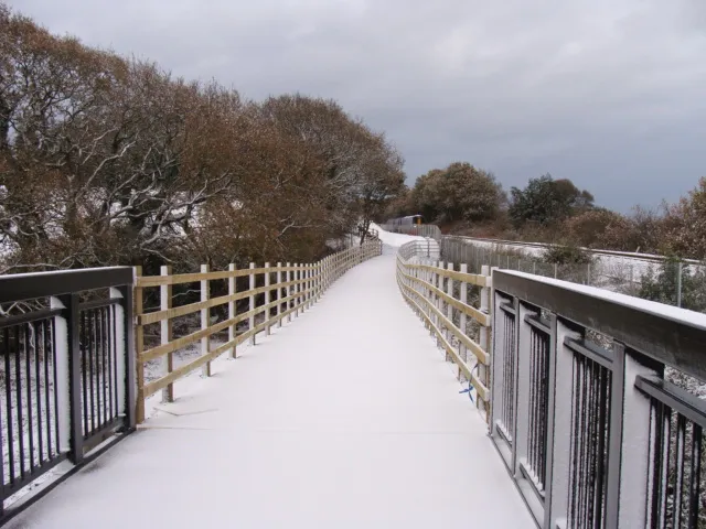
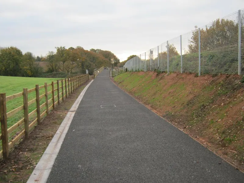
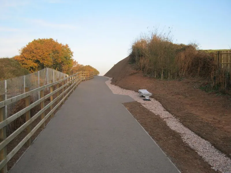
Sticking with Devon, the Exe Estuary Trail is getting another step closer to completion. Work on the eastern side between Exton and Topsham has been finished, with an opening imminent. This means that a largely off-road route now exists all the way from the centre of Exeter to the coast at Exmouth. Once complete, this trail will be a fantastic leisure route and will link 80,000 Devon residents.
Kent
A new 5km traffic-free section of National Route 18 is now in place between Canterbury and Chartham.
Midlands
Spring should see the completion of a stretch of greenway linking Bridgnorth and Coalport.
New route guides
Cycleroutes.com
New website www.cycleroutes.com offers several route planning tools in one place. The three main features are downloadable routes (£1.99 gets you a PDF of the route on OS Landranger 1:50,000 mapping, plus a GPX file which is said to work with the majority of GPS devices and smartphones), route books and maps for sale, and an excellent free-to-use cycle route planner that lets you plan a route between any two locations in the UK up to 50km apart (search by quickest route, quietest or most recreational).
Innertube Map of Edinburgh
This is a clever schematic map showing some fine routes throughout the Scottish capital, colour-coded in the style of the London tube map. There are also detailed street-level maps of the city designed for on-the-ground navigation, but its creators, the Bike Station, wanted an eyecatching design that would also act as a poster-style advert for the city’s extensive traffic-free cycle route network.
To develop the map further, £98,000 of funding has been awarded to carry out conservation work along cycle paths in the north of Edinburgh, as well as to improve signage and other amenities. An interactive map and website is planned.
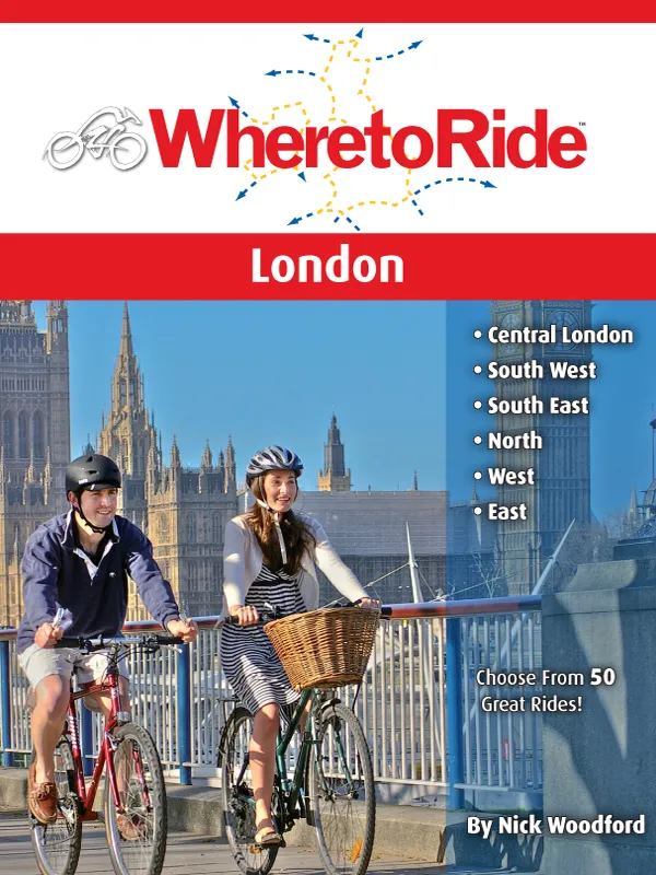
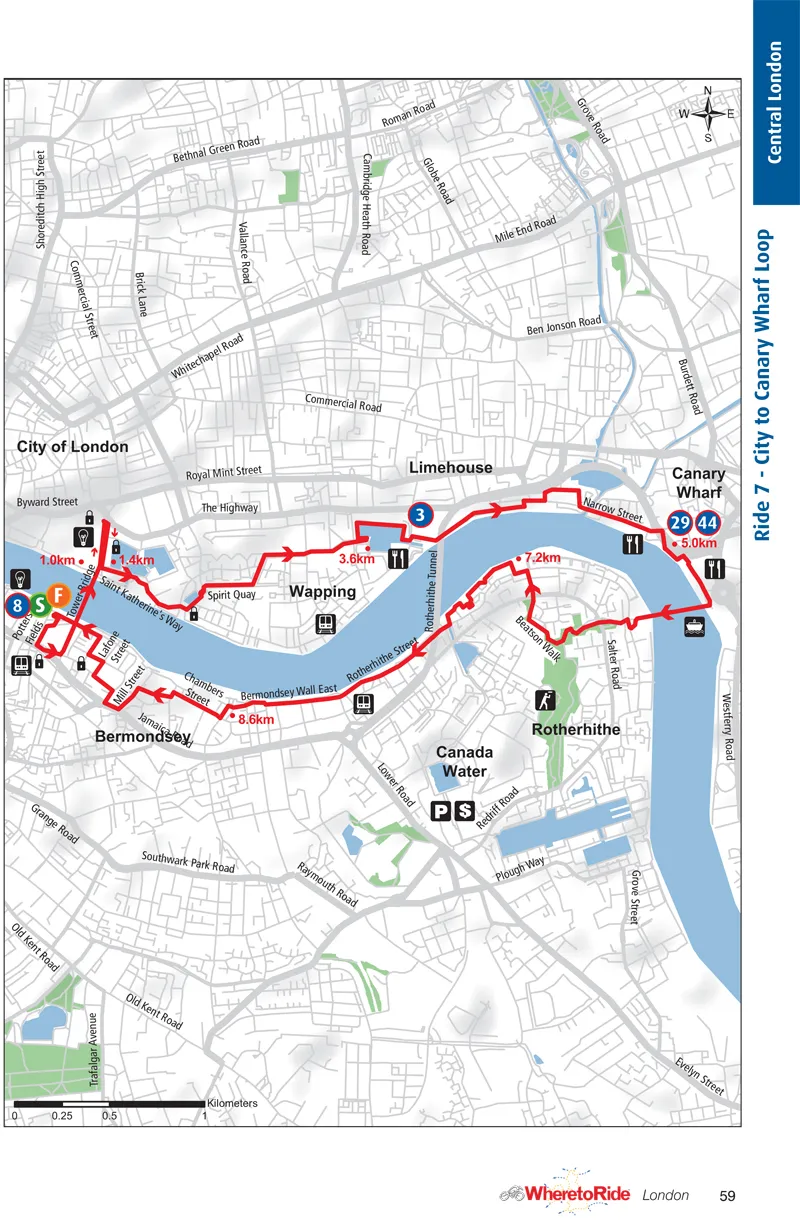
Where to Ride: London (ISBN 978-0-9803546-9-0, £14.95 Nick Woodford / BA Press)
This book contains 50 rides throughout Greater London mapped and described in great detail. The clever mapping system used means streets are identifiable by name – crucial in London – but each ride map still fits neatly onto a page. Useful facilities – train stations, picnic areas and recommended food stops and the like – are shown as logos and tied in with the text detail.
As well as the usual suspects such as traffic-free rides in the Royal Parks and alongside Regent's Canal, there are more unusual rides such as one linking a host of museums and another linking the centre's best sights and viewpoints. There are also many exploring outer London's green spaces and attractions. Highly recommended. Available from www.cordee.co.uk.
Cycling Days Out: Southeast England (ISBN 978-1-9066148-24-9, £14.95, Deirdrie Huston / Vertebrate Publishing)
This contains 26 mainly very short family rides throughout the South East, covering Kent, Sussex, Surrey, London Parks and Hampshire. There are high quality photography and maps, plus supporting info. Given the extent of the area covered and the size of the book (240 pages and 19cm square) quite a few more rides could have been covered. Still, a handy addition for cyclists wanting short family rides in the area. Available from www.cordee.co.uk.