The best cycling apps will help you plan a route, train effectively, fix your bike and much more. There's no shortage of apps aimed at cyclists, with many more being released all the time, so sometimes it can be difficult to sort the wheat from the chaff.
Fear not – these are 20 of the most useful apps for cycling, as recommended by the BikeRadar team.
We've included a variety of cycling apps for iPhone and Android devices, ranging from highly analytical training tools to simpler social apps and useful navigational resources.
For some apps – Google Maps, for instance – you need to have your device on the handlebar to take full advantage. For others, such as Strava, you can just hit start, put your phone in your jersey pocket or in a bike phone mount and go.
What's more, with Bluetooth accessories such as heart-rate monitors, speed sensors and power meters becoming more common, you can get your smartphone’s Bluetooth connection and processor to do the work that used to require a separate computer and, not so long ago, wires.
Some of the apps featured here are free, some are not, and some are free up front with an option to buy or subscribe for more bells and whistles. The best indoor training apps cost just over £12 a month and the best smart trainers will get the most out of your subscription.
Fair warning: any GPS cycling app will tax your phone's battery, so these are generally better suited to shorter rides unless you're able to charge on the go. The best bike computers will last much longer.
And remember, these are our recommendations, so make sure to add your own in the comments.
The best cycling apps in 2024
To make the list more digestible, we've grouped our favourite cycling apps into ride recording, navigation and route planning, fitness, mountain biking and miscellaneous categories.
Use the links below to jump to the section you need:
- Best cycling apps for tracking your rides
- Best cycling apps for routes and navigation
- Best cycling apps for fitness
- Best cycling apps for indoor training
- Best apps for mountain biking
- Best miscellaneous apps for cyclists
undefined
Best cycling apps for tracking your rides
The best cycling apps for tracking will record your ride and show your speed, distance, route and other metrics, such as elevation.
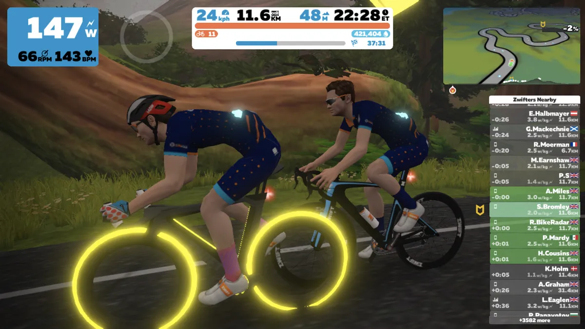
These are probably the most popular cycling apps out there, with Strava leading the field (and offering a host of other features, including segments, leaderboards and route planning).
Strava
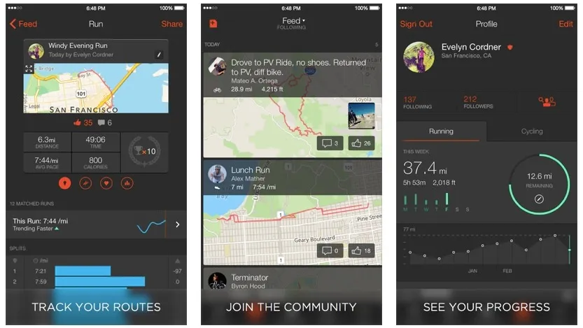
While you can use Strava like a cycle computer on your phone, most riders use a separate GPS computer to record and upload their rides and then use the app to see what their friends are up to.
All rides uploaded to Strava deliver automatic rankings of your times over popular stretches of road and trail – known as 'segments' in Strava-speak – along with a GPS map of where you rode.
The real-time feature, which tells you how fast you are tracking on a selected segment, such as the local hard climb, works on smartphones but also newer Garmin Edge and Wahoo computers, too.
Strava’s special sauce, which separates it from its competitors, is the slick social component. Much like Facebook, you can follow friends and see where and how hard they’re riding, leave comments and give kudos on their rides, as well as post photos of your own rides.
Strava pivoted heavily towards a subscriber model in 2020, putting formerly free features such as segment leaderboards and route planning behind a paywall.
Cycling-related 'Points of Interest', such as cafes and bike shops, show up in Strava's base map in its app and browser.
- Price: Free (premium version also available — £6.99 monthly / £47.99 annually)
- Download: Strava for iOS or Strava for Android
- BikeRadar is on Strava: Join the BikeRadar Strava club
MapMyRide
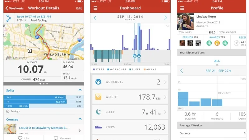
MapMyRide is similar to CycleMeter, but benefits from the parent company’s online history with route-mapping software.
The app is well-equipped for tracking not only rides but nutrition, weight and more, and can also get you to your destination.
The premium version includes training plans, more advanced routing options and live tracking that can be shared with family and friends. The premium version also ditches the advertisements you’re stuck with on the free app.
- Price: Free (premium version also available — $5.99 monthly / $29.99 yearly)
- Download: MapMyRide for iOS or MapMyRide for Android
Best cycling apps for route planning and navigation
Cycling apps for route planning and navigation will help you discover more roads and places to ride.
The best cycling apps aimed at route planning will allow you to plan your own rides as well as discover routes from other riders.
Some apps will do the heavy lifting and plan a route for you if you enter a destination, which is ideal for on-the-go adventures or cycling around town.
Bikemap
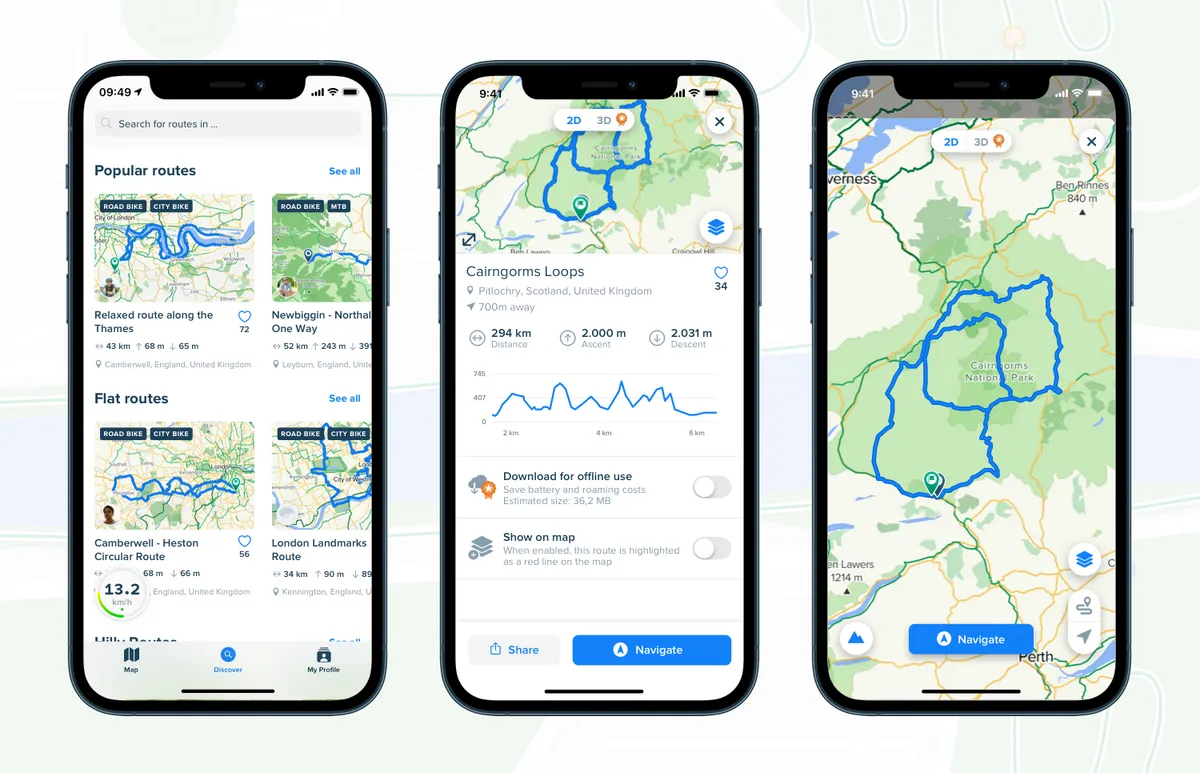
Bikemap is an iPhone and Android app that offers route planning, navigation, real-time updates and plenty more.
In our experience, it’s a good alternative to Strava or Komoot for route planning and offers more for free, though both Strava and Komoot also have their own unique features.
The app’s real-time updates allow you to alert other Bikemap users to problems encountered during a ride. It’s not something we’ve found much use for, but might be more appealing to cyclists riding regularly in an urban environment.
Other features include an archive of more than seven million user-generated routes, route collections and in-app ride stats.
Most of Bikemap’s features are free to use, but there’s also a Bikemap Premium service, which opens up additional mapping options, including cycling-friendly map layers and 3D views of your planned routes, as well as offline navigation.
- Price: Free (Premium version also available – £9 / €9 / $12 / AU$14.99 / monthly £35 / €39 / $49 / AU$59.99/ annually / £89 / €99 / $99 / AU$179.99 one-off payment for lifetime access)
- Download: Bikemap for iOS or Bikemap for Android
Google Maps
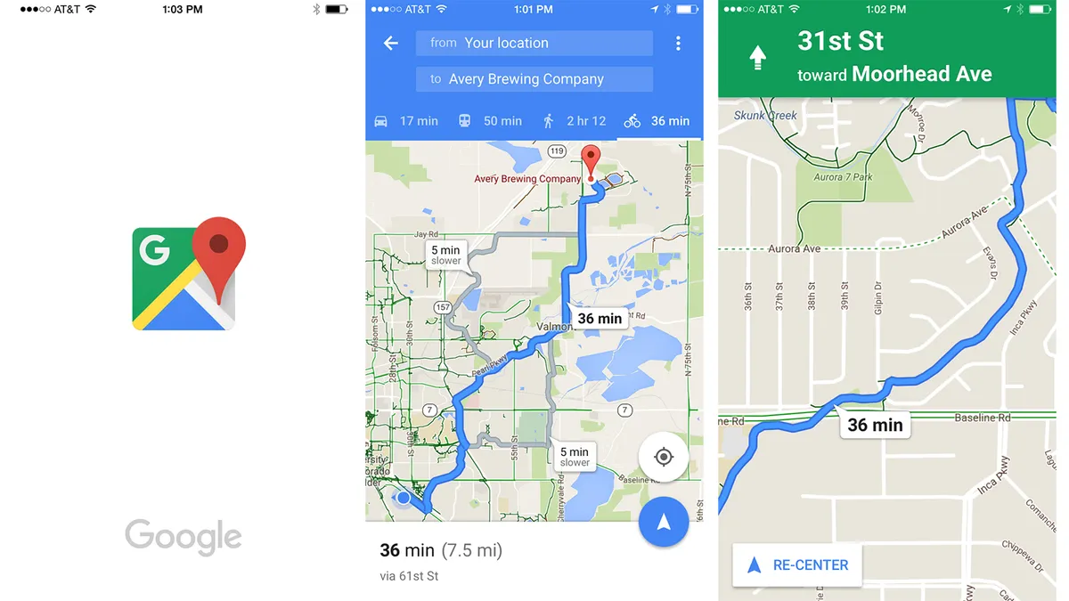
Apple has done some amazing things in the world of tech, but it can't beat Google at mapping.
Just like you use your phone on the fly to find places, read a few reviews and then go to the one you select, you can use Google Maps to do this too – and get there on bike paths and bike-friendly routes.
Like any app, it’s not foolproof, but in its category it's among the best there is. The audio turn-by-turn instructions are nice when riding, too; for riders who choose to ride with headphones, you can have your phone in your pocket and easily get where you need to be.
- Price: Free
- Download: Google Maps for iOS or Google Maps for Android
Komoot
While Google Maps is arguably the gold standard for dealing with navigation in general, it can sometimes come up a bit short for bike directions.
Komoot uses the open-source OpenStreetMap database and allows you to plan road, mountain bike and gravel rides as well as commutes. The big difference over Google Maps is in the routing, where Komoot tries to choose the most efficient route, taking into account how bike-friendly a road or path is, as well as your fitness.
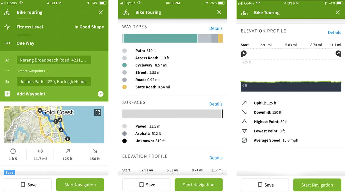
Using a start and end point, Komoot will tell you the difficulty, fitness required, what road surfaces you’ll come across and an elevation profile to boot.
Once you’ve started your route, it will give you speed, distance travelled, distance remaining and allows for easy on-the-fly route changes. You can also check out other route recommendations in your local area.
Komoot also features curated highlights, as suggested by local riders and Komoot ambassadors. These can be a great way to discover unknown gems in your local area.
A premium subscription unlocks additional features, such as a multi-day planner and live tracking.
Want to know more? We've got a complete guide to Komoot.
- Price: First map region free, subsequent map regions £3.99 / €3.99 / $3.99 (Premium — £59.99 / €59.99 / $59.99 annually)
- Download: Komoot for iOS or Komoot for Android
Ride with GPS
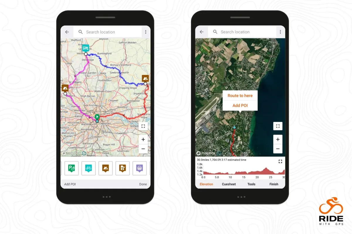
Ride with GPS can plan routes in great detail, navigate and record your ride.
It's got a user-friendly interface that allows you to start recording with a single tap, and can even be used to navigate offline, which makes it extremely useful out in the sticks or on long rides, where preserving battery power is important.
The route data provided is particularly helpful, with detailed elevation profiles that you can zoom in and out of, and see exactly where on the route the biggest climbs will be.
Want to share your rides in real time? The app lets you do just that, and it will even read comments aloud as you pedal. Not a bad thing to have when you need that last motivational push.
The free version allows you to create routes and record your rides, as well as set yourself goals. There's a Basic subscription that gives you access to mobile app features such as turn-by-turn navigation, live logging and offline mapping. You can also publish ride reports.
The Premium version gives you all of this, plus advanced route editing, custom cue sheets, stationary bike support and private segments.
- Price: Free / Basic £6 /€6 / $6 monthly / £50 / €50 / $50 yearly / Premium £10 / €10 / $10 monthly / £80 / €80 / $80 yearly
- Download: Ride with GPS for iOS or Ride with GPS for Android
OS Maps
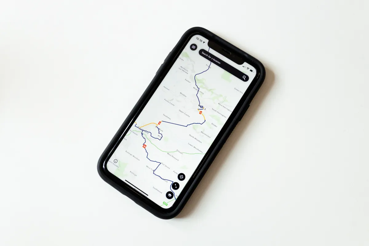
To some, paper OS Maps are a joy to use and things of beauty. But anyone who's grappled with a South Pembrokeshire OS Explorer as it flaps in an Atlantic onshore wind will appreciate this app's practicality. It's a cartological database of the whole UK on your mobile device.
You can plot and record rides on the app, but the plethora of more cycling-focused alternatives make it a better research tool for us two-wheeled explorers.
The map overlays are handy for cyclists. The Greenspace option highlights grassy areas for off-road routes, while the National Cycle Network one displays quiet lanes and family-friendly routes.
For free, you can access the standard maps, aerial and night maps online. A subscription includes premium features, such as all 25,000 (Explorer) and 50,000 (Landranger) maps on- and offline.
The Landranger is brilliant for planning long rides and multi-day epics. It shows towns and campsites for stop-offs. The more detailed Explorer is useful for poring over the terrain of gravel or mountain bike adventures, for example to differentiate byways and bridleways from footpaths where cycling isn't permitted. You could research in the app then plot the route on Komoot, which is easier to sync to your GPS computer.
If you remember how to read them from school, the Explorer's contour lines and slope direction arrows show hills to avoid or include. Cleverly, you can set the app to flip between each view as you zoom in and out.
- Price: Free or £2.99 monthly/£23.99 annually for premium subscription
- Download: OS Maps for iOS or OS Maps for Android
Best cycling apps for fitness
The best cycling apps for fitness will help you track your performance over time.
They work particularly well with other sensors such as heart rate monitors and power meters to provide a whole load of data that will give you a greater insight into your riding. Some, such as TrainingPeaks, offer training plans dedicated to different abilities and goals.
Wahoo Fitness
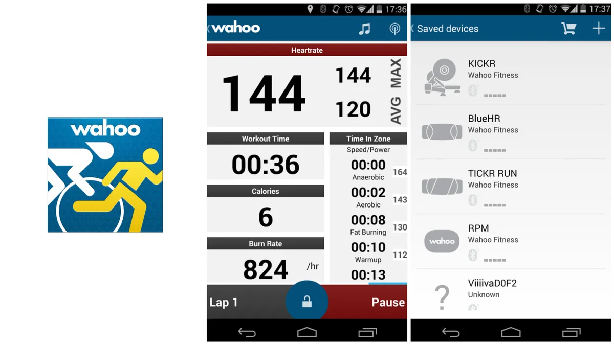
Perhaps the biggest draw of the Wahoo Fitness app is that it plays nicely with others.
It pairs easily with Bluetooth sensors, such as heart-rate monitors, speed sensors and progressive power meters, including Stages (with a Wahoo Key plugin you can pair with ANT sensors, too).
In a world where many companies guard your data in their ecosystems, Wahoo Fitness uploads to all the good sites – Strava, MapMyFitness, TrainingPeaks, MyFitnessPal – and, if you like, can push your data in your choice of five file formats via email or Dropbox.
If you’re a data hound, you’ll love the number-heavy presentation of the app, with eight customisable pages of data on speed, power, heart rate and more. Plus, there’s a GPS map – though it burns through the battery pretty quickly.
The app can also be used indoors with Wahoo's indoor smart trainers.
- Price: Free
- Download: Wahoo Fitness for iOS or Wahoo Fitness for Android
TrainingPeaks
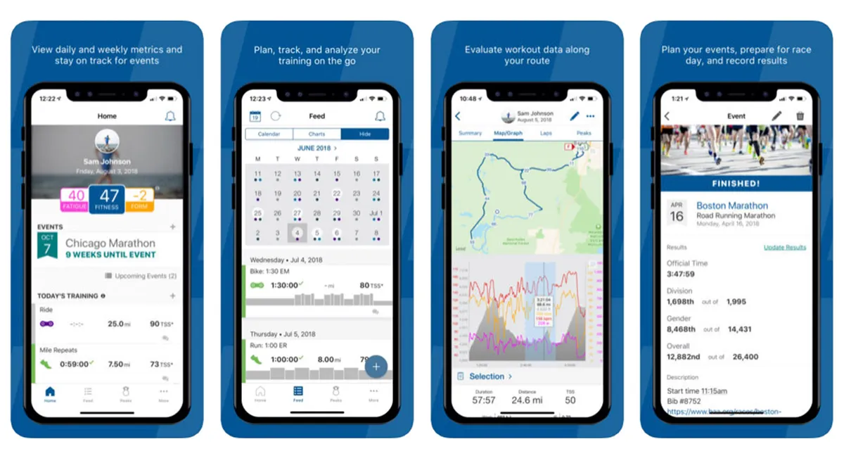
If you’ve ever had a cycling coach, you’ve probably used TrainingPeaks. Heck, even if you haven’t had a coach you may have used TrainingPeaks.
For everyone from coaches and high-performance athletes, to data-hungry office-based crit enthusiasts, TrainingPeaks offers one of the most comprehensive tools for tracking fitness and fatigue.
However, it is not to be confused with a social network, navigation, or route-planning app, so look elsewhere if that's what you're after.
The app allows you to create and schedule workouts, or choose from a wide selection of training plans crafted by coaches such as Joe Friel and Frank Overton.
- Price: Free (premium versions from $9.92 monthly)
- Download: TrainingPeaks for iOS or TrainingPeaks for Android
Cyclemeter
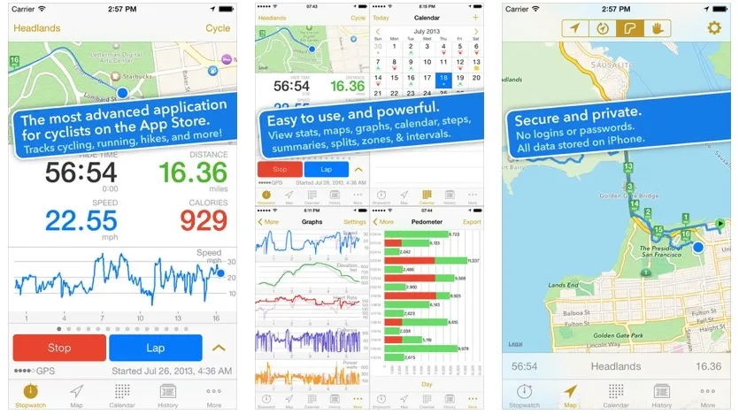
Cyclemeter turns your smartphone into a great cycling computer – if you’re down with putting your phone on your handlebars, that is.
It's similar to Wahoo Fitness in its wealth of customisable options during the ride, but you also get a smorgasbord of post-ride analysis. Plus, you don’t have to log into any site; the data stays on your device.
You can start/stop rides with your iPhone earphone remote button, too (if you choose to ride with headphones), and integrated Google Maps can assist you in unfamiliar areas.
Cyclemeter also plays nicely with Strava, Facebook, Twitter and more, while importing and exporting routes is also easy.
- Price Free (in-app upgrades available for $9.99 each)
- Download Cyclemeter for iOS or Cyclemeter for Android
Elite HRV
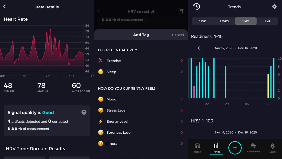
For those who don’t already have enough data and metrics in their life, the Elite HRV app provides an easy way to track your heart rate variability (HRV).
Over time, HRV data can be used as a marker for monitoring your recovery from training and your readiness (or otherwise) to take on more training load.
You’ll need a compatible Bluetooth heart rate monitor, such as a Polar H10 heart rate strap (a full list of compatible devices can be found on Elite HRV’s website), but you’ll be able to track your HRV for free, with unlimited data storage.
You can also tag each reading with relevant information such as your mood, stress levels and recent activity, to help give further context to your results.
As you build up a longitudinal profile, the app will then be able to give you insights into your potential readiness for physical activity after each reading.
There are also paid tiers, which offer more advanced insights and readiness information, but for those interested in dipping their toes into using HRV as a training aid, the free tier offers a great deal in an easy-to-digest format.
- Price: Free (premium versions from $8 monthly)
- Download: Elite HRV for iOS or Elite HRV for Android
Best cycling apps for indoor training
Indoor training apps are designed to make sitting on the turbo trainer a far more enjoyable experience. They are a great way to avoid bad weather and get riding when the rest of life stops you from cycling outside.
Some indoor training apps are focused solely on training, with personalised workouts and training plans based on power output and intervals, while others enable you to race against other riders or simply admire the virtual scenery. Here are some of our favourites.
Wahoo X
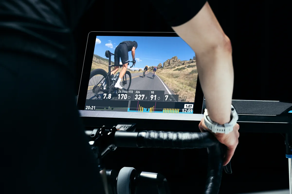
Wahoo X is a subscription service that gives access to Wahoo SYSTM and Wahoo RGT, which was renamed after Wahoo purchased RGT Cycling.
Wahoo RGT offers the same experience as RGT Cycling, where users ride simulations of real-world climbs rather than in virtual worlds like on Zwift.
Wahoo SYSTM is an indoor training app that does things a little differently to the likes of Zwift and other smart trainer apps. It doesn't have a virtual world, but you can ride simulations of pro race finales. In the On Location feature, you ride along to videos of real-world roads.
Having swallowed The Sufferfest, Wahoo SYSTM runs in the same vein as the no-frills workout gallery did. It's for dedicated athletes who'd like to follow a structured training plan, while there is the option to pick and choose workouts. Some of them can be performed outdoors.
Wahoo creates a bespoke training schedule for you after identifying your strengths and weaknesses using the brand's own Four Dimensional Power Profile (4DP). This is meant to give a more nuanced picture of your fitness than a Functional Threshold Power test.
- Price: Free 14-day trial for new users, then $14.99 monthly or $129.99 annually
- Download: Wahoo SYSTM for iOS or Wahoo SYSTM for Android / Wahoo RGT for iOS or Wahoo RGT for Android
Zwift
With an internet connection, turbo trainer and device compatible with the app, riders across the world can ride with or race each other inside the world of Zwift.
As well as being an efficient training tool, thanks to the built-in workouts and training plans, Zwift promotes social interaction and is a great way to break up the tedium of indoor riding.
- Price: £12.99 / $14.99 per month
- Download: Zwift for iOS or Zwift for Android
Rouvy
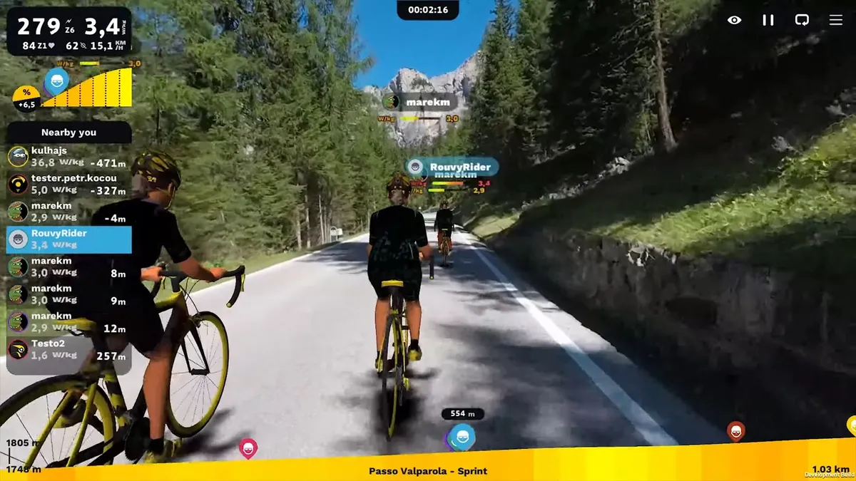
Rouvy is an indoor cycling app that offers a growing number of real-life routes and augmented reality courses for you to ride on.
Unlike Zwift, which simulates virtual worlds and roads, Rouvy uses video recordings of real roads and combines them with elevation data to provide an interactive riding experience. On certain courses, the app can also generate animated 3D riders.
Beyond augmented reality, there are also – at the time of writing – approximately 2,036,020km of route films to 'ride' on, which should keep you entertained for several lifetimes.
The app is available for iOS and Android, as well as for PCs, Apple TV and more.
- Price: $12 / €12 monthly
- Download: Rouvy for iOS or Rouvy for Android
TrainerRoad
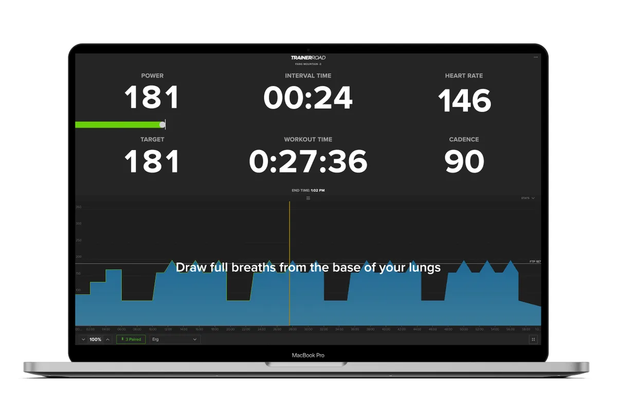
Compared to Zwift and Wahoo X, TrainerRoad takes a stripped-back approach to indoor training. Instead of entertaining you with virtual worlds, races and group rides, TrainerRoad focuses solely on making you faster with a personalised training plan.
TrainerRoad claims the app uses AI to adjust your plan to your performance levels in sessions, increasing the difficulty if you're going better or decreasing it if you're struggling.
This leads to fewer unfinished sessions and more subscribers increasing their Functional Threshold Power, according to TrainerRoad.
The app is available on iOS, Android, Mac and Windows.
- Price: $19.95 monthly / $189 annually (equivalent to $15.75 a month) following free 30-day trial
- Download: TrainerRoad for iOS or TrainerRoad for Android
Best apps for mountain biking
Many cycling apps are focused on road cycling, building on already available technology like Google Maps. But there are also dedicated mountain biking apps that will help you make the most of the trails.
Trailforks
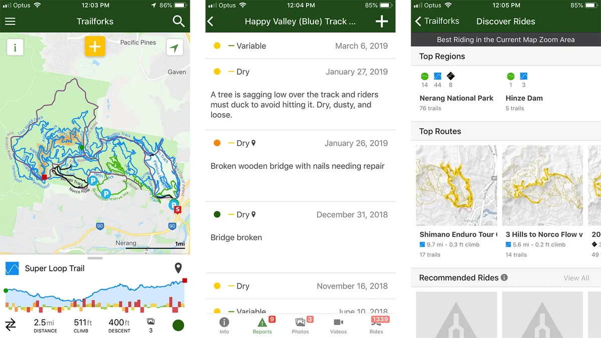
You’re riding a new trail network, you’ve been out for a few hours, it’s hot, you’re tired and ready for a rest, when you come to a fork in the trail. You took a picture of the trail map near the car park, but you’re not totally sure where you are, so you make a call and go left because you think the trailhead is in that direction. Turns out, you've picked the wrong one, and this trail takes you deeper into the forest – you’re now a bit lost and try to backtrack to get home. It’s in this situation that Trailforks comes to rescue.
Relying on crowd-sourced information, the app has more than 161,000 trails around the world and includes conditions reports, live tracking and even points of interest, such as bike shops, in case you need a spare tube.
The maps are downloaded onto your device for offline use, so no worries if you lose reception.
The app also has an emergency info function that will generate your exact GPS coordinates and the name of the nearest trail.
The free version gives full access to one area and partial view anywhere for emergency navigation. The premium version adds unlimited worldwide maps and downloadable routes.
- Price: Free or premium €1.66 monthly/ €20 annually
- Download: Trailforks for iOS or Trailforks for Android
More of the best cycling apps
Bike maintenance, first aid, weather forecasts and just pure entertainment. If you can think of something novel or useful, someone has probably made an app for it.
Here's a selection of some of the best cycling apps the team at BikeRadar love to use. They might not fit into the categories we've already featured, but in most cases they are simply too useful not to have.
What3words
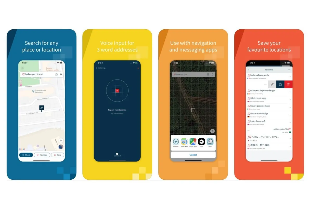
What3words takes a unique approach to finding, sharing and navigating to a precise location, having assigned every single 3m x 3m square in the world with a unique combination of three words.
The app is pitched as the new global standard for communicating location, whether it's for coordinating meeting points with friends, finding your tent at a festival or directing the emergency services to exactly the right spot in a remote place or undefined location. It's not a totally foolproof system but, for those who don't know how to give a grid reference or coordinates, it's a quick and easy way to communicate your location.
It's compatible with navigation apps such as Google Maps, Apple Maps, Waze and others – just add the three-word address. You can also use voice command.
- Price: Free
- Download: What3words for iOS or What3words for Android
First Aid by British Red Cross

If the worst should happen on a ride, it pays to be prepared. While it’s hard to beat going on a proper first aid course, this is probably the next best thing.
Using a range of videos, quizzes and step-by-step advice, the First Aid by British Red Cross app helps you learn how to deal with common first aid emergencies, as well as being an invaluable reference when things go wrong.
All the information is stored on the phone, so it’ll also work fine when you don’t have a data connection.
- Price: Free
- Download: First Aid by British Red Cross for iOS or First Aid by British Red Cross for Android
Relive
Using ride data from Wahoo, Garmin Connect, MapMyRide and more (but no longer Strava), Relive generates a 3D video flyover of your ride, similar to the course previews shown ahead of WorldTour road races.
The moving map not only shows your progress over the route but also pinpoints where you hit your top speed and the elevation profile, as well as any photos you may have taken along the way.
- Price: Free or Relive Plus premium version — first thirty days are free then £6.99 monthly / £38.99 yearly
- Download: Relive for iOS or Relive for Android
DotWatcher.cc
If you're into long-distance racing, DotWatcher is a must-visit.
Managed and updated by a small team – all of whom are experienced long-distance racers – the site hosts tracking maps, insight and analysis on the majority of major long-distance bicycle races.
There is no dedicated app available, but the site is very well mobile-optimised, so there's no reason to stop tracking on the go.
The web app was also recently updated to include profiles for each rider featured, making following your long-distance heroes that bit easier.
- Price Free
- Visit DotWatcher.cc
MyWindsock
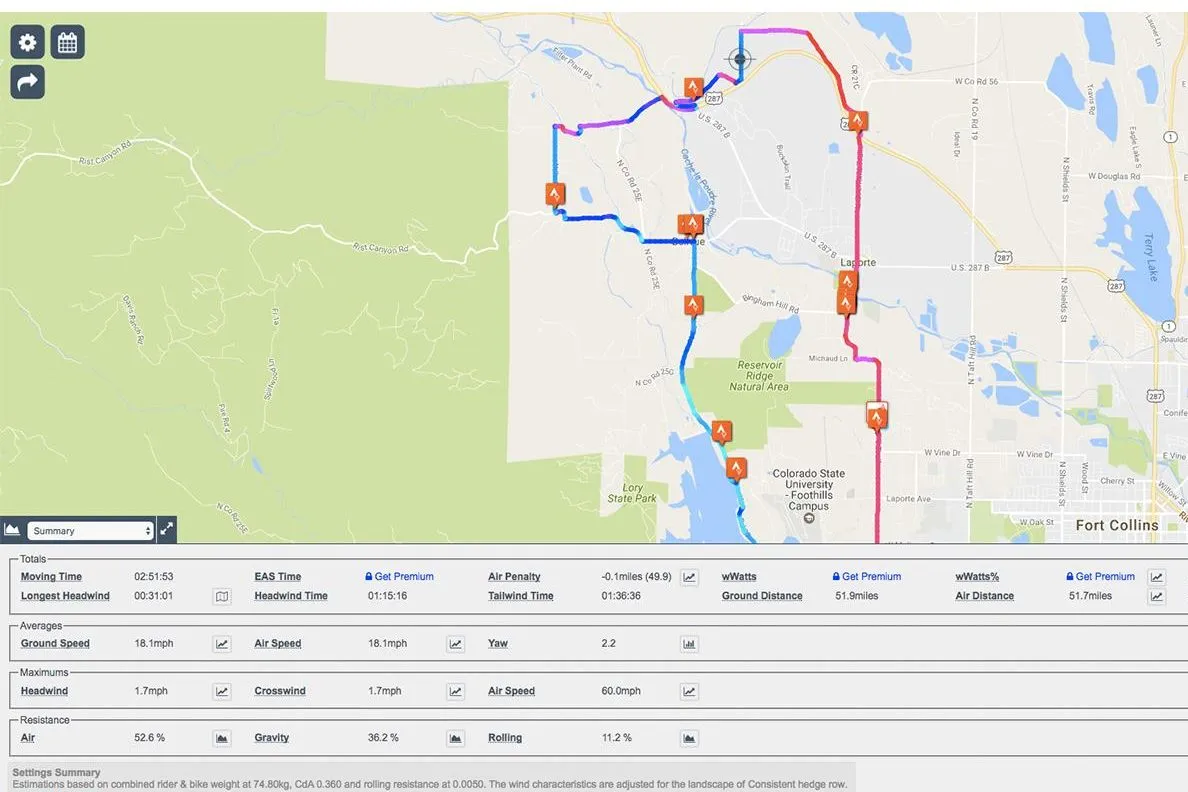
While not a downloadable app, MyWindsock is a properly nerdy, mobile-compatible web app that will delight KOM/QOM-hunting Strava users the world over.
The site pulls weather data from the Cloud and overlays a heat map of where you are most likely to encounter head, cross and tailwinds over a Strava segment or ride.
This allows you to focus your efforts on segments that will have the most advantageous wind, or, if you’re a real TT-freak, alter your setup for a race depending on the conditions. Totally nerdy, totally brilliant.
- Price Free or premium features from £9.99 monthly
- Visit MyWindsock.com